Dive slate · divesites.com.au · printed 7 Nov 2026
Direction Island Unidentified Wreck
Cocos (Keeling) Islands, External Territories · near West Island
| Depth | 3–4 m |
|---|---|
| Minimum level | Snorkel/Any |
| Difficulty | Beginner |
| Access | Boat (day trip) |
| Entry | Giant stride or back roll from dive boat |
| Current | Mild |
| Visibility | 20-40 m |
| Water | summer 28-29 °C, winter 26-27 °C |
| Suit | 3 mm wetsuit or rash vest year-round |
| Best season | November–April (doldrum season, light winds); diveable year-round when the south-east trades allow |
| Bottom time | 45 min |
| Position | -12.09870, 96.88030 (GPS) |
| Permit | Protected under the Underwater Cultural Heritage Act 2018 (Commonwealth) – look but do not touch, disturb or remove anything; plus Cocos (Keeling) Islands Marine Park Habitat Protection zone rules |
| Nearest chamber | Fiona Stanley Hospital (Perth) – about 2,700 km away via aeromedical evacuation; there is no recompression chamber on Cocos or Christmas Island |
| Emergency | 000 · DAN Asia-Pacific diving emergency 1800 088 200 |
Direction Island Unidentified Wreck
Also known as Gudden Barstow (probable), Port Refuge keelson wreck
A 40 m keel and keelson line from an unidentified 19th-century North American ship – possibly the Gudden Barstow (1839) – in under 4 m of clear water.
Near West Island · Cocos (Keeling) Islands, External Territories
- Depth
- 3–4 m
- Minimum level
- Snorkel/Any
- Access
- Boat (day trip)
- Boat ride
- —
- Water
- 28-29 °C
- Visibility
- 20-40 m
Direction Island Unidentified Wreck3–4 m · Snorkel/Any
Dive factsDepths, conditions, location & safety
Season
In season nowBest months: year-round.
November–April (doldrum season, light winds); diveable year-round when the south-east trades allow
- Best months
- Now (November)
- Stinger suit Nov–May
Dive facts
- Depth
- 3–4 m
- Typical depth
- 4 m
- Certification
- Snorkel/Any
- Difficulty
- Beginner
- Depth tier
- Easy (0–10 m)
- Access
- Boat (day trip)
- Dive centre needed
- Recommended
- Shore / independent
- No
- Current
- Mild
- Visibility
- 20-40 m
- Water temp (summer)
- 28-29 °C
- Water temp (winter)
- 26-27 °C
- Water
- Tropical
- Bottom time
- 45 min
- Dive traffic
- Rarely dived (private boat/club only)
- Night dive
- No
- Snorkel friendly
- Yes
Exposure suit
3 mm wetsuit or rash vest year-round
Location
Port Refuge – south of Direction Island · Cocos (Keeling) Islands – Indian Ocean
-12.09870, 96.88030
Published GPS position.
Open in Google MapsDive site map (external) →Primary source: museum.wa.gov.auMarine park & permits
Protected under the Underwater Cultural Heritage Act 2018 (Commonwealth) – look but do not touch, disturb or remove anything; plus Cocos (Keeling) Islands Marine Park Habitat Protection zone rules
Nearest recompression chamber
Fiona Stanley Hospital (Perth) – about 2,700 km away via aeromedical evacuation; there is no recompression chamber on Cocos or Christmas Island
Diving emergency: call 000, then DAN AP 1800 088 200.
Trip planner
Build a trip around Direction Island Unidentified Wreck →
A day-by-day plan for Cocos (Keeling) Islands with this site locked in.
This guide is a planning aid. Conditions change daily — confirm with a local dive centre and dive within your training. Data & safety notes.
Dive profile
How this site rates
Scores are computed from the recorded data, not opinions. How?
At a glance
Direction Island Unidentified Wreck is a wreck boat dive in Cocos (Keeling) Islands, Australia's external territories, 3–4 m, suitable for snorkellers and first-time divers.
Rated beginner: sheltered, shallow and manageable for a newly certified diver on a normal day, though note boat traffic overhead.
Why dive here
- A 40 m keel and keelson line from an unidentified 19th-century North American ship – possibly the Gudden Barstow (1839) – in under 4 m of clear water.
- Snorkel-friendly, so non-diving companions can join at the surface.
- Rarely dived: expect to have the site to yourself, and plan your own logistics.
- Visibility often reaches 20-40 m.
Conditions to avoid
- Strong southerly or south-east swell and wind
- Cyclone season (roughly December–April)
About Direction Island Unidentified Wreck
South of Direction Island, in 3.8 m on a clean white-sand bottom, lies the backbone of an old wooden ship. The WA Museum's inspection report records six rows of concreted iron keel and keelson bolts running for 40 m across hard sand, the central pair rising about 30 cm and the flanking pairs about 10 cm, with traces of floor timbers, thin planking and buried frames. The length of the bolt run suggests a vessel of about 40 m between perpendiculars.
For many years divers took the structure to be the remains of an old jetty. Timber analysis found white oak and southern yellow pine, pointing to a North American-built ship, and the report names the American ship Gudden Barstow of New Bedford, wrecked at Cocos in 1839, as a prime candidate. Documentary records mention American whalers being dismantled at this anchorage, and the Clunies-Ross family salvaged almost everything of value from the wreck in the 19th century, leaving only the keel and keelson assembly, which was too robust to break up.
The site is stable and well protected by the eastern reef from the trades, although cyclones may periodically expose and rebury parts of it. As a dive it is modest – a line of concreted bolts on sand, with little structure for fish – but it is a rare, tangible trace of the whaling-era history of Cocos, which predates the Clunies-Ross settlement's copra industry and the cable station. The shallow, clear water makes it an easy snorkel for visitors with a boat, and it is interesting to combine with the Phaeton and the Catalina for a heritage tour of Port Refuge.
The site is protected underwater cultural heritage.
Wreck details
Unidentified wooden sailing ship, about 40 m; possibly the American ship Gudden Barstow (New Bedford, wrecked 1839)
Getting there & entry
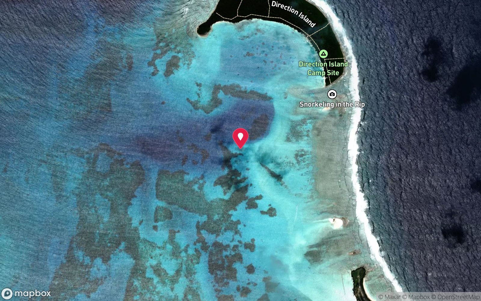
Keel and keelson remains of an unidentified 19th-century wooden ship in 3.8 m on sand, about 0.5 nautical mile south of Direction Island (WA Museum position 12°05.924'S, 96°52.815'E).
Fly to West Island on the twice-weekly Virgin Australia service from Perth (usually routed via Christmas Island; allow 7–10 days on the islands to absorb weather and flight delays). Cocos Dive collects divers from West Island accommodation in the morning (pickup around 8 am, departure about 9 am) and runs its boats from West Island into the lagoon. The wreck lies in 3.8 m on clean sand about 0.5 nautical mile south of Direction Island, in the north-east corner of the lagoon.
It is not marked and is visited only on request with a local skipper or Cocos Dive. It is not reachable from the Direction Island ferry landing without a boat.
Entry: Giant stride or back roll from dive boat
Facilities: Departs West Island; no shops or fuel on the outer islands – Cocos Dive supplies lunch on day trips.
Weather, swell & tides
Cocos has two seasons. The south-east trades blow steadily from roughly April/May to October, often 15–25 knots, which chops up the lagoon and pushes swell onto the eastern and southern outer reefs; divers are then kept to sheltered sites. The doldrum season (November to March/April) brings lighter, variable winds, flatter seas and the widest choice of outer-reef sites, and is the best time to dive, though it is also the tropical cyclone season and squalls pass through.
Port Refuge, the north-western corner of the lagoon between Horsburgh and Direction Islands, is shallow and protected from ocean swell by the reef, but in strong trades it becomes choppy and the fine sand stirs up, lowering visibility. Dive or snorkel on calm days and around high tide on the incoming flow for the clearest water; tidal streams through the northern passages can be noticeable at mid-tide. The site sits in the lee of the eastern reef and is protected from the prevailing trades.
Best season: November–April (doldrum season, light winds); diveable year-round when the south-east trades allow
If it's blown out
Sheltered or shore sites within 25 km that often work when Direction Island Unidentified Wreck doesn't.
- The Rip (Direction Island) · 1 km · Max 8 m
- Broccoli Patch · 0 km · Max 10 m
- Phaeton Wreck · 3 km · Max 6 m
- Pulu Maraya · 9 km · Max 5 m
How the dive is usually run
Snorkel or dive along the 40 m run of concreted keel and keelson bolts, starting at one end and swimming its length. There is little relief, so the whole site can be seen in a short dive; spend the rest of the time on the surrounding sand looking for rays and gobies.
Marine life
- Sand-dwelling fish
- gobies
- stingrays
- juvenile reef fish
Linked species have their own page listing every site where they are recorded. All marine life →
Training required
Shallow enough for snorkellers and for a first dive under supervision. Any certified diver can dive it.
Depth tiers: 0–10 m easy · to 18 m Open Water · 18–30 m Advanced (25 m+ is a deep dive) · 30–40 m Deep specialty · 40 m+ technical. All courses
Hazards & warnings
Protected heritage – do not touch or remove anything. Lagoon boat traffic; use a float or stay near the boat. No chamber on the islands (nearest Fiona Stanley Hospital, Perth, by aeromedical evacuation).
Dive centres that go here
No regular operator. Cocos Dive or a local lagoon skipper (Cocos Blue Charters, Cocosday Tours) may visit on request.
Operators recorded for Direction Island Unidentified Wreck
Cocos Dive
ListedWest Island · Cocos (Keeling) Islands · WA
The main dive operation in the Cocos Keeling Islands, servicing atoll and outer reef diving.
cocosdive.com · 0498 080 187
Cocos Blue Charters
Named by sitesWest Island · Cocos (Keeling) Islands · External Territory
Charter boat operator (dive/fishing/snorkel charters).
cocosblue.com.au · (08) 9162 6579
Cocosday Tours
Named by sitesWest Island · Cocos (Keeling) Islands · External Territory
Boat tours, fishing, motorised canoe tours and boat hire; not a scuba dive shop.
cocosislandsboatandfishing.com · (08) 9162 7741
Map
7 pinned sites. Pins marked approximate on their pages show the general area only; not for navigation.
Satellite views
Direction Island Unidentified Wreck: frequently asked questions
How deep is Direction Island Unidentified Wreck?
Direction Island Unidentified Wreck reaches a maximum depth of 4 m, with the shallowest part at about 3 m; most of the dive is spent around 4 m.
What certification do I need to dive Direction Island Unidentified Wreck?
No certification is needed to snorkel it, and it suits introductory dives. Rated beginner: sheltered, shallow and manageable for a newly certified diver on a normal day, though note boat traffic overhead.
Can I shore dive Direction Island Unidentified Wreck?
No, it is reached by boat.
When is the best time to dive Direction Island Unidentified Wreck?
November–April (doldrum season, light winds); diveable year-round when the south-east trades allow.
What marine life will I see at Direction Island Unidentified Wreck?
Regularly recorded: Sand-dwelling fish, gobies, stingrays, juvenile reef fish.
What wetsuit do I need at Direction Island Unidentified Wreck?
3 mm wetsuit or rash vest year-round.
How cold is the water at Direction Island Unidentified Wreck?
Typically 28-29 °C in summer and 26-27 °C in winter.
What are the main hazards at Direction Island Unidentified Wreck?
Protected heritage – do not touch or remove anything. See the hazards section above for the full list.
Where is the nearest recompression chamber to Direction Island Unidentified Wreck?
Fiona Stanley Hospital (Perth) – about 2,700 km away via aeromedical evacuation; there is no recompression chamber on Cocos or Christmas Island. In an emergency call 000, then DAN Asia-Pacific on 1800 088 200.
Diving in Cocos (Keeling) Islands
Cocos is a true coral atoll 2,750 km north-west of Perth, with 27 islands around a shallow turquoise lagoon and an outer reef that drops to deep water. Manta rays feed in the channels, green turtles are everywhere, dolphins visit the boats, and the outer walls hold grey reef sharks, tuna and huge schools of fusiliers. Two sites, the Cabbage Patch and the Rip, are among the best drift dives in the Indian Ocean.
Getting there: Fly from Perth via Christmas Island. One operator on West Island runs boat dives on the outer reef and lagoon; some lagoon sites can be reached by kayak or a long swim.
All Cocos (Keeling) Islands dive sites and a suggested itinerary →
Sources
Data confidence: Medium · Being verified: Rarely visited; no operator lists it as a regular site. Identity unconfirmed so wreck_year_sunk left blank.. Last updated September 2026. Know this site better? How to send a correction
Nearby dive sites
More wrecks in External Territories
Explore more
This region
Similar dives