Dive slate · divesites.com.au · printed 7 Nov 2026
The Crossroads
Jervis Bay, New South Wales · near Huskisson
| Depth | 25–42 m |
|---|---|
| Minimum level | Technical (decompression) |
| Difficulty | Expert/Technical |
| Access | Boat |
| Entry | Back roll from boat; anchor with plenty of rope |
| Current | Mild |
| Visibility | 15-25 m |
| Water | summer 18-22 °C, winter 15-17 °C |
| Suit | 5–7 mm wetsuit with hood in summer–autumn; 7 mm semi-dry or drysuit June–October |
| Best season | Winter westerlies |
| Bottom time | 18 min |
| Position | -35.08200, 150.82250 (approximate) |
| Permit | Jervis Bay Marine Park (NSW) – check the zoning map: sanctuary zones (no take of any kind) cover much of the Beecroft Peninsula coast including Drum and Drumsticks, The Docks area and Bowen Island; special grey nurse shark rules apply. No permit needed for recreational diving. Beecroft Peninsula is the Department of Defence Beecroft Weapons Range. Road access to Point Perpendicular, Honeymoon Bay, Long Beach and the peninsula's bays is only when the range is open to the public (generally Friday afternoon to Sunday and NSW school/public holidays – confirm with Range Control on 02 4448 3411 or the range Facebook page), and sea areas off the peninsula can be closed during live firing; check Notices to Mariners and range notices before a boat trip. |
| Nearest chamber | Prince of Wales Hospital (Randwick, Sydney) – approx. 3 h by road from Jervis Bay; call 000 and DAN Asia-Pacific hotline (evacuation usually by air) |
| Emergency | 000 · DAN Asia-Pacific diving emergency 1800 088 200 |
The Crossroads
Also known as Crossroads
Pristine vertical wall at 30–39 m with pineapplefish, blue devils and anemone-draped sea whips.
Near Huskisson · Jervis Bay, New South Wales
- Depth
- 25–42 m
- Minimum level
- Technical (decompression)
- Access
- Boat
- Boat ride
- ~30 min
- Water
- 18-22 °C
- Visibility
- 15-25 m
The Crossroads25–42 m · Technical (decompression)
Dive factsDepths, conditions, location & safety
Season
Off-peak nowBest months: June, July, August.
Dive facts
- Depth
- 25–42 m
- Typical depth
- 35 m
- Certification
- Technical (decompression)
- Difficulty
- Expert/Technical
- Depth tier
- Technical (40 m +)
- Access
- Boat
- Offshore
- 0.2 km
- Dive centre needed
- Yes – boat access only
- Shore / independent
- No
- Boat ride
- ~30 min
- Current
- Mild
- Visibility
- 15-25 m
- Water temp (summer)
- 18-22 °C
- Water temp (winter)
- 15-17 °C
- Water
- Temperate
- Bottom time
- 18 min
- Dive traffic
- Rarely dived (private boat/club only)
- Night dive
- No
- Snorkel friendly
- No
Exposure suit
5–7 mm wetsuit with hood in summer–autumn; 7 mm semi-dry or drysuit June–October
Location
Beecroft Peninsula – outer coast · Shoalhaven – Jervis Bay
-35.08200, 150.82250
Approximate position — not for navigation.
Open in Google MapsPrimary source: michaelmcfadyenscuba.infoMarine park & permits
Jervis Bay Marine Park (NSW) – check the zoning map: sanctuary zones (no take of any kind) cover much of the Beecroft Peninsula coast including Drum and Drumsticks, The Docks area and Bowen Island; special grey nurse shark rules apply. No permit needed for recreational diving. Beecroft Peninsula is the Department of Defence Beecroft Weapons Range. Road access to Point Perpendicular, Honeymoon Bay, Long Beach and the peninsula's bays is only when the range is open to the public (generally Friday afternoon to Sunday and NSW school/public holidays – confirm with Range Control on 02 4448 3411 or the range Facebook page), and sea areas off the peninsula can be closed during live firing; check Notices to Mariners and range notices before a boat trip.
Nearest recompression chamber
Prince of Wales Hospital (Randwick, Sydney) – approx. 3 h by road from Jervis Bay; call 000 and DAN Asia-Pacific hotline (evacuation usually by air)
Diving emergency: call 000, then DAN AP 1800 088 200.
Trip planner
Build a trip around The Crossroads →
A day-by-day plan for Jervis Bay with this site locked in.
This guide is a planning aid. Conditions change daily — confirm with a local dive centre and dive within your training. Data & safety notes.
Dive profile
How this site rates
Scores are computed from the recorded data, not opinions. How?
At a glance
The Crossroads is a wall boat dive in Jervis Bay, NSW, 25–42 m, suited to Technical (decompression) divers, about 30 minutes by boat.
Rated expert/technical because of depth to 42 m, cold water.
Why dive here
- Pristine vertical wall at 30–39 m with pineapplefish, blue devils and anemone-draped sea whips.
- Rarely dived: expect to have the site to yourself, and plan your own logistics.
- Visibility often reaches 15-25 m.
Conditions to avoid
- Strong southerly or south-east swell and wind
- Afternoon north-easterlies
About The Crossroads
The Crossroads is a deep wall site on the outer Beecroft Peninsula a few hundred metres north of The Arch, and possibly part of the same reef system. The bottom drops from about 30 m to around 39 m along a wall that McFadyen describes as quite vertical, with depths beyond 40 m possible if you swim away from the structure. Large boulders lie at the base, giving way to sand. The main wall runs north–south, and several cracks cut into it running towards the north-west – perhaps the origin of the name. There may be deeper sections to the east that have yet to be confirmed.
The wall is covered in colourful sponges, sea squirts and sea whips, many hosting tiger anemones. Eastern blue devilfish and pineapplefish shelter in the cracks, yellowtail are abundant, and fur seals sometimes appear from the Beecroft Peninsula colonies.
This is explicitly a decompression dive. McFadyen's account describes about 18 minutes on the wall followed by a five-minute ascent and roughly eight minutes of mandatory decompression, using 27% oxygen as bottom gas and 63% for decompression. The site is therefore suited to technically trained divers with appropriate gas planning. Anchor drift into deeper water is a real risk, so plenty of rope and a surface support plan are needed. Published information is limited – GPS marks were listed as 'to come' – so confidence in the precise location is moderate. For qualified divers it offers pristine deep wall scenery with few other visitors, and the nearby Arch and Whorehouse provide shallower options for the second dive.
Getting there & entry
Vertical north–south wall a few hundred metres north of The Arch, dropping from 30 m to about 39 m with cracks running north-west; a decompression dive.
Charters depart Huskisson (Dive Jervis Bay; boats in Currambene Creek). Private boats launch at Huskisson, Callala Bay or Murrays Beach (Booderee), or at Currarong's ocean ramp. From Huskisson cross the bay to the entrance and turn north around Point Perpendicular onto the outside of the Beecroft Peninsula; the site is a few hundred metres north of The Arch (about 30 minutes from Huskisson).
Run in from open water as the sounder shows the bottom rising from over 40 m to 30 m and then 25 m, and anchor with plenty of rope because the anchor can drift into deeper water. McFadyen had not yet published GPS marks.
Entry: Back roll from boat; anchor with plenty of rope
Facilities: Departure from Huskisson: Dive Jervis Bay shop (air, nitrox, hire), cafés, parking; Huskisson and Callala ramps.
Weather, swell & tides
The outer Beecroft Peninsula cliffs face east to south-east and take the full force of any south-easterly or easterly swell; the sites are diveable in swell under about 1.5 m and are well sheltered from south-westerly and westerly winds, which make them the go-to sites in winter. North-easterly winds (common on summer afternoons) make the run from Huskisson across the bay entrance rough and cause surge on the northern-facing cliffs. Visibility is commonly 15–25 m and can reach 30 m in winter when clear oceanic water sits against the peninsula.
Currents along the cliffs are usually mild but can run at the bay entrance on a strong tide change. Defence live-firing closures can shut the sea area – check before going.
Best season: Winter westerlies
If it's blown out
Sheltered or shore sites within 25 km that often work when The Crossroads doesn't.
- Murrays Beach · 8 km · Max 12 m
- Scottish Rocks · 10 km · Depth not published
- Hyams Beach · 12 km · Max 10 m
- Honeymoon Bay · 7 km · Max 10 m
How the dive is usually run
Descend to the wall top at about 30 m and follow the vertical face along its north–south line at 35–39 m, investigating the cracks that run north-west. After about 18 minutes at depth ascend over 5 minutes and complete planned decompression stops (McFadyen's example: EAN27 bottom gas, EAN63 for about 8 minutes of stops).
Marine life
- Eastern blue devilfish →
- pineapplefish
- yellowtail
- Australian fur seals →
- sponges
- sea squirts
- sea whips
- tiger anemones
Linked species have their own page listing every site where they are recorded. All marine life →
Training required
Beyond recreational limits: decompression, mixed gas or full cave/wreck training is required.
Courses that help here
- Enriched Air Nitrox – Longer no-decompression time at 25 m and deeper.
- Drysuit Diver – Cold water; locals dive dry for much of the year.
Depth tiers: 0–10 m easy · to 18 m Open Water · 18–30 m Advanced (25 m+ is a deep dive) · 30–40 m Deep specialty · 40 m+ technical. All courses
Hazards & warnings
Decompression dive; depth near 40 m; anchor can drift deeper; exposed coast; Defence firing-range sea closures.
Technical notes
Plan as a light decompression dive: EAN27 (or trimix) bottom gas with EAN50–63 for deco; full redundancy and DSMB.
Dive centres that go here
Technical and experienced divers by arrangement with Jervis Bay operators; private boats.
Operators recorded for The Crossroads
Other dive centres in Jervis Bay
Indepth Scuba
ProfiledBelconnen · Jervis Bay · NSW
A Canberra operation that functions as both a training school and a life-support service facility, with cylinder testing and a full range of gas fills.
indepthscuba.com.au · (02) 6251 1070
Lady of the Sea Diving Academy
ProfiledTuggeranong (Canberra, ACT) · Jervis Bay · NSW
A Canberra operation with an unusually complete set of facilities for an inland centre, including an onsite pool, classroom, retail shop and dive boat.
ladyofthesea.com.au · +61 407 487 735
Crest Diving
Named by sitesJervis Bay · Jervis Bay · NSW
Escorted shore dive tours; no shopfront address published.
crestdiving.com.au · 0414 787 281
Woebegone Freedive
Named by sitesHuskisson · Jervis Bay · NSW
Freediving school; official site live (Unit 3/1 Erina Rd Huskisson) with online bookings and a TripAdvisor Travellers' Choice 2026 award.
woebegone.com.au
Deep 6 Diving Jervis Bay
Reported closedHuskisson · Jervis Bay · NSW
Former domain deep6divingjervisbay.com.au now serves unrelated SEO content; only stale directory listings remain.
Map
7 pinned sites. Pins marked approximate on their pages show the general area only; not for navigation.
Satellite views
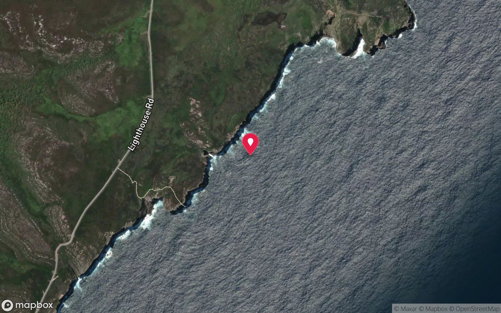
The Crossroads: frequently asked questions
How deep is The Crossroads?
The Crossroads reaches a maximum depth of 42 m, with the shallowest part at about 25 m; most of the dive is spent around 35 m.
What certification do I need to dive The Crossroads?
Technical (decompression) is the recommended minimum. Rated expert/technical because of depth to 42 m, cold water.
Can I shore dive The Crossroads?
No, it is reached by boat (about 30 minutes). A dive centre is required: boat access only.
When is the best time to dive The Crossroads?
Winter westerlies.
What marine life will I see at The Crossroads?
Regularly recorded: Eastern blue devilfish, pineapplefish, yellowtail, Australian fur seals, sponges, sea squirts, sea whips, tiger anemones.
What wetsuit do I need at The Crossroads?
5–7 mm wetsuit with hood in summer–autumn; 7 mm semi-dry or drysuit June–October.
How cold is the water at The Crossroads?
Typically 18-22 °C in summer and 15-17 °C in winter.
What are the main hazards at The Crossroads?
Decompression dive; depth near 40 m; anchor can drift deeper; exposed coast; Defence firing-range sea closures. See the hazards section above for the full list.
Where is the nearest recompression chamber to The Crossroads?
Prince of Wales Hospital (Randwick, Sydney) – approx. 3 h by road from Jervis Bay; call 000 and DAN Asia-Pacific hotline (evacuation usually by air). In an emergency call 000, then DAN Asia-Pacific on 1800 088 200.
Diving in Jervis Bay
Jervis Bay's white sand and clear water make it the best-known dive destination on the NSW south coast. The Docks, Stoney Creek and the Arch on the northern headland, and Cabbage Tree Point on the south, are boat dives with sponge gardens, grey nurse sharks in season and fur seals from Drum and Drumsticks. Inside the bay, Hyams Beach, Murrays Beach and the Green Patch reefs are gentle shore dives with seadragons and octopus.
Getting there: Two and a half hours south of Sydney. Dive shops in Huskisson run daily charters; shore dives inside the bay have car parks at Hyams, Murrays and Green Patch (Booderee National Park entry fee applies).
Sources
Data confidence: Medium · Being verified: No GPS published – coordinates approximate.. Last updated September 2026. Know this site better? How to send a correction
Nearby dive sites
More wall dives in New South Wales
Explore more
This region
Similar dives