Dive slate · divesites.com.au · printed 8 Nov 2026
City of Rayville
Surf Coast & Great Ocean Road, Victoria · near Apollo Bay
| Depth | 70–82 m |
|---|---|
| Minimum level | Technical (decompression) |
| Difficulty | Expert/Technical |
| Access | Boat |
| Entry | Shot line and descent from a technical charter vessel |
| Current | Variable/Tidal |
| Visibility | 10-25 m |
| Water | summer 15-18 °C, winter 11-13 °C |
| Suit | 7mm semi-dry with hood and gloves in summer; drysuit strongly preferred May–November |
| Best season | Late summer and autumn (Feb–Apr) in extended high-pressure spells |
| Bottom time | 25 min |
| Position | -38.98000, 143.51000 (approximate) |
| Permit | Commonwealth Apollo Marine Park (Habitat Protection Zone); protected historic shipwreck – no artefact removal |
| Nearest chamber | The Alfred (Melbourne) |
| Emergency | 000 · DAN Asia-Pacific diving emergency 1800 088 200 |
City of Rayville
Also known as SS City of Rayville, Cape Otway mine wreck
The first American merchant ship lost in WWII, intact and upright in 82 m off Cape Otway – Victoria's premier deep technical wreck.
Near Apollo Bay · Surf Coast & Great Ocean Road, Victoria
- Depth
- 70–82 m
- Minimum level
- Technical (decompression)
- Access
- Boat
- Boat ride
- ~75 min
- Water
- 15-18 °C
- Visibility
- 10-25 m
City of Rayville70–82 m · Technical (decompression)
Dive factsDepths, conditions, location & safety
Season
Off-peak nowBest months: January, February, March, April, May, December.
Late summer and autumn (Feb–Apr) in extended high-pressure spells
- Best months
- Now (November)
Dive facts
- Depth
- 70–82 m
- Typical depth
- 78 m
- Certification
- Technical (decompression)
- Difficulty
- Expert/Technical
- Depth tier
- Technical (40 m +)
- Access
- Boat
- Offshore
- 14 km
- Dive centre needed
- Yes – boat access only
- Shore / independent
- No
- Boat ride
- ~75 min
- Current
- Variable/Tidal
- Visibility
- 10-25 m
- Water temp (summer)
- 15-18 °C
- Water temp (winter)
- 11-13 °C
- Water
- Temperate
- Bottom time
- 25 min
- Dive traffic
- Remote/expedition only
- Night dive
- No
- Snorkel friendly
- No
Exposure suit
7mm semi-dry with hood and gloves in summer; drysuit strongly preferred May–November
Location
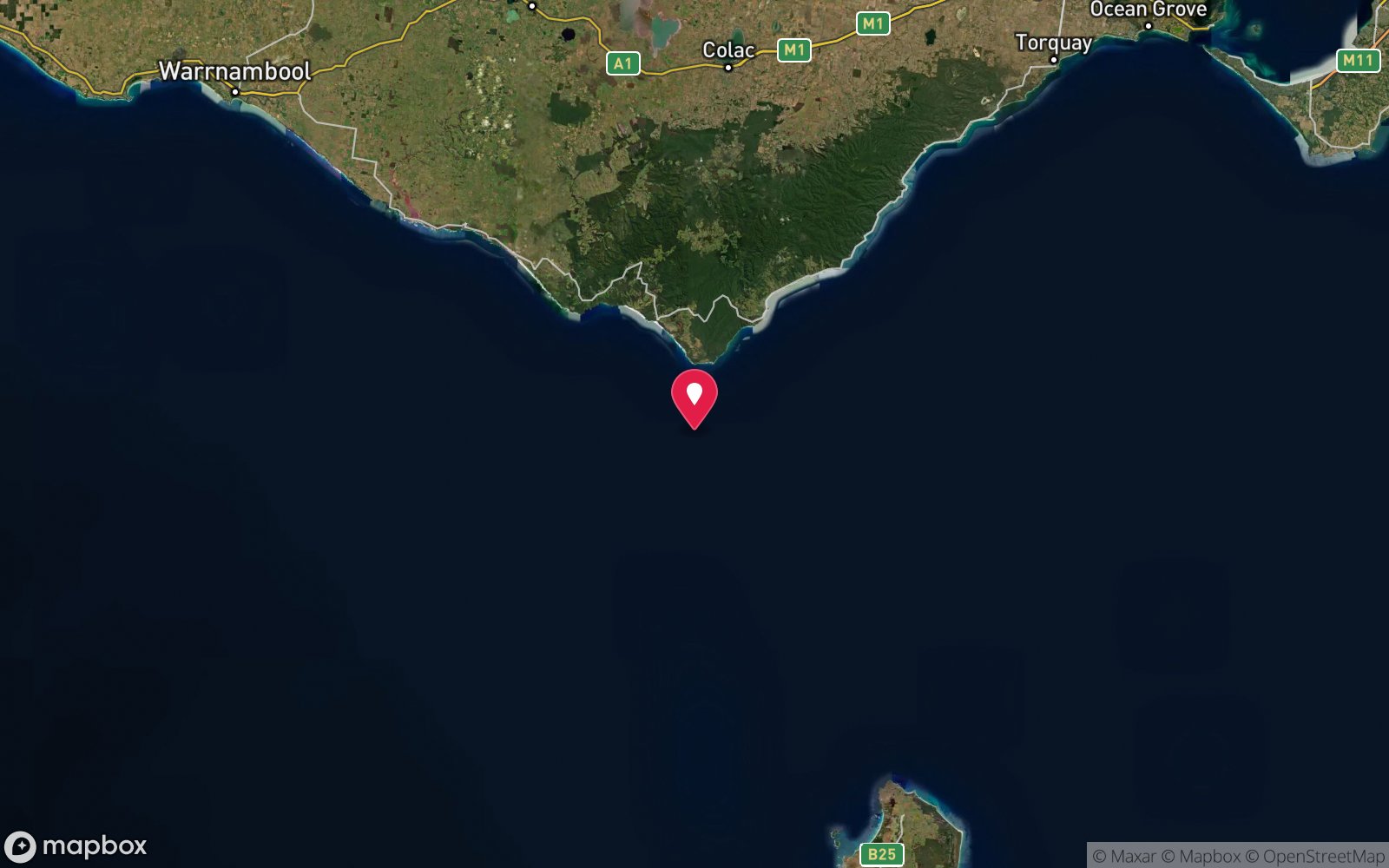
Apollo Marine Park (offshore Cape Otway) · Great Ocean Road – Cape Otway
-38.98000, 143.51000
Approximate position — not for navigation.
Open in Google MapsPrimary source: scubadoctor.com.auMarine park & permits
Commonwealth Apollo Marine Park (Habitat Protection Zone); protected historic shipwreck – no artefact removal
Nearest recompression chamber
The Alfred (Melbourne)
Diving emergency: call 000, then DAN AP 1800 088 200.
Trip planner
Build a trip around City of Rayville →
A day-by-day plan for Surf Coast & Great Ocean Road with this site locked in.
This guide is a planning aid. Conditions change daily — confirm with a local dive centre and dive within your training. Data & safety notes.
Dive profile
How this site rates
Scores are computed from the recorded data, not opinions. How?
At a glance
City of Rayville is a wreck boat dive in Surf Coast & Great Ocean Road, VIC, 70–82 m, suited to Technical (decompression) divers, variable/tidal current, about 75 minutes by boat.
Rated expert/technical because of depth to 82 m, tidal current that must be timed, cold water.
Why dive here
- The first American merchant ship lost in WWII, intact and upright in 82 m off Cape Otway – Victoria's premier deep technical wreck.
- Sunk in 1940 (Steel cargo steamer, 5,883 GRT, c. 122 m); protected as underwater cultural heritage, so look but do not touch.
- Rarely dived: expect to have the site to yourself, and plan your own logistics.
- Visibility often reaches 10-25 m.
About City of Rayville
The City of Rayville was a 5,883-ton American steel freighter built in 1920 at Tampa, Florida, for the United States Shipping Board and operated in 1940 by the Pioneer Line. On the evening of 8 November 1940, bound from Adelaide to Melbourne with a cargo of lead, she struck a mine laid across the western entrance to Bass Strait by the German auxiliary minelayer Passat, working with the raider Pinguin. The explosion blew off the foremast and opened the forward holds; the ship sank in about 40 minutes some 6 miles south of Cape Otway. Thirty-seven of the 38 crew got away in the boats and were brought into Apollo Bay by local fishermen; the third engineer, who went back for belongings, drowned. The same minefield had sunk the British steamer Cambridge off Wilsons Promontory the day before. The City of Rayville has a place in history as the first American merchant ship lost in the Second World War, more than a year before the United States entered it, and a memorial stands on the Apollo Bay foreshore.
The wreck was located by sonar in the early 2000s and lies upright on sand in about 82 m, with the hull and superstructure standing 5–6 m clear of the seabed. Survey imagery shows the steering house, hatch coamings, ladders, railings and deck winches still in place, and the hull largely intact apart from the mine damage forward. It sits within the Commonwealth Apollo Marine Park and is protected under the Underwater Cultural Heritage Act. For divers this is one of the deepest and least visited wrecks in Victoria: a trimix or rebreather dive with a long run offshore, cold water, poor weather odds and no regular charter, undertaken only by well-equipped technical teams. It is included here as the outstanding deep wreck of the Otway coast rather than as a practical dive for most readers.
The ship and the sinking
The City of Rayville was an American freighter of the Isthmian Line, 5,883 tons, on passage from Adelaide to Melbourne with a cargo of lead, wool and dried fruit. On the night of 8 November 1940 she struck a mine off Cape Otway, one of a field laid the week before by the German auxiliary cruiser Passat; the British liner Cambridge had been sunk by the same field the night before. One crewman, Mack Bryan, died; the rest were rescued by the Apollo Bay lifeboat. She was the first United States merchant ship lost in the Second World War, more than a year before the country entered it.
Her position was known approximately from the survivors' accounts but the wreck was not found and dived until the 2000s, when technical divers from Victoria located her intact and upright in 82 m.
What is there today
She is Victoria's premier deep technical wreck: upright, largely intact, with the bridge, holds and derricks recognisable in the clear water of the Otway coast. Dived by trimix teams out of Apollo Bay in calm autumn weather; she is a protected historic shipwreck.
Wrecks older than 75 years, and several younger ones, are protected under the Underwater Cultural Heritage Act 2018: look, photograph, take nothing. Australia's oldest wreck dives →
Wreck details
Steel cargo steamer, 5,883 GRT, c. 122 m · Sunk 1940 · Protected historic shipwreck
Era: Second World War. Oldest wrecks · Wartime wrecks · Scuttled warships
Other wrecks of the same era
- HMAS Goorangai · Max 15 m · Port Phillip Heads
- SS Orungal · Max 10 m · Surf Coast & Great Ocean Road
- SS Kakariki · Max 10 m · Melbourne & Port Phillip Bay
- Batman · Max 46 m · Port Phillip Heads
- Burke · Max 50 m · Port Phillip Heads
- Fawkner · Max 46 m · Port Phillip Heads
Getting there & entry
American freighter mined in 1940, lying upright on sand in about 82 m roughly 14 km south of Cape Otway, inside the Commonwealth Apollo Marine Park.
Technical boat dive only. Charter or private technical boats launch from Apollo Bay harbour (Breakwater Road ramp) and run about 25 km south-west to the position, 60–90 minutes in a fast boat depending on sea state; Port Campbell's crane launch is the only alternative to the west and is unsuitable for larger vessels. The Australian National Shipwreck Database position is regarded as unreliable and the wreck must be relocated by sounder.
Expeditions are organised by Melbourne technical dive groups and are weather-dependent for days at a time.
Entry: Shot line and descent from a technical charter vessel
Facilities: Apollo Bay harbour ramp, fuel and fishermen's co-op; no technical gas in Apollo Bay – bring all gas from Melbourne.
Weather, swell & tides
Fully exposed to the Southern Ocean off the most notorious cape in Victoria. Requires swell under about 1 m and winds under 10 knots for a full day, which happens on only a few days a year, usually in late summer and autumn under a slow-moving high. Surface currents and a west-setting drift are common and a live-boat pick-up with a drifting deco station is standard practice.
Fog and rapid frontal changes are hazards. Water at depth is cold year-round (11–14 °C) and the Bonney Upwelling can bring cold, green water inshore in summer. Slack water is not the constraint; sea state and the long run home are.
Best season: Late summer and autumn (Feb–Apr) in extended high-pressure spells
If it's blown out
Sheltered or shore sites within 25 km that often work when City of Rayville doesn't.
- Crayfish Bay, Cape Otway · 14 km · Max 10 m
- Parker Inlet, Cape Otway · 16 km · Max 10 m
- Blanket Bay, Cape Otway · 18 km · Max 10 m
How the dive is usually run
Descend the shot to the deck at about 75 m, confirm the shot is secure, then work along one side of the hull past the hatch coamings, winches and steering house on the stern, keeping the run-time tight. Bottom time of 20–25 minutes on trimix gives a total run time of well over two hours; ascend the shot or a deployed deco station and complete staged decompression with team bailout and surface support.
Marine life
- Deep-reef fish over the hull
- schooling butterfly perch and boarfish reported on similar Bass Strait wrecks
- sponges and hydroids on the upperworks; little documented
Linked species have their own page listing every site where they are recorded. All marine life →
Training required
Beyond recreational limits: decompression, mixed gas or full cave/wreck training is required.
Courses that help here
- Enriched Air Nitrox – Longer no-decompression time at 25 m and deeper.
- Drysuit Diver – Cold water; locals dive dry for much of the year.
Depth tiers: 0–10 m easy · to 18 m Open Water · 18–30 m Advanced (25 m+ is a deep dive) · 30–40 m Deep specialty · 40 m+ technical. All courses
Hazards & warnings
82 m depth requiring trimix and staged decompression; remote position 14 km offshore with a long run in open sea; strong surface drift; cold water; fog and rapid weather changes; no nearby chamber; protected wreck in a Commonwealth marine park.
Technical notes
Trimix (e.g. 12/60) or CCR with bailout; typical plan 20–25 min bottom time, 120–150 min run time; deco on 50% and O2; drifting deco station and live-boat recovery recommended; surface support with O2 and satellite communication essential. Protected under the Underwater Cultural Heritage Act 2018 – no disturbance.
Dive centres that go here
No regular operator. Rare expeditions by Melbourne-based technical dive groups (trimix/rebreather) using chartered or private vessels from Apollo Bay; the wreck has been dived only a handful of times since it was located.
Other dive centres in Surf Coast & Great Ocean Road
The Scuba Doctor
ProfiledRye · Melbourne & Port Phillip Bay · VIC
A Victorian equipment and service business with an extensive retail presence, located to serve both Melbourne and Mornington Peninsula divers.
scubadoctor.com.au · (03) 5985 3322
Bay City Scuba
ListedEast Geelong · Melbourne & Port Phillip Bay · VIC
A Victorian business associated with recreational and technical training alongside equipment and gas services.
baycityscuba.com · (03) 5248 1488
Divein2Scuba (Geelong Dive Centre)
ListedGeelong · Geelong & Bellarine · VIC
A Geelong business providing training, equipment and local diving support.
divein2scuba.com · (03) 5221 3342
Scubabo Dive Victoria (Dive Victoria Group)
Named by sitesQueenscliff · Port Phillip Heads · VIC
Rebranded as Scubabo Dive Victoria, Queenscliff; dive.scubabo.com is live for 2026 with active charter bookings.
dive.scubabo.com · (03) 5258 1188
Warrnambool Diving
Named by sitesWarrnambool · Shipwreck Coast & Warrnambool · VIC
Trades as Warrnambool Diving & Firearms.
divingandfirearms.com.au · (03) 5562 1685
Red Boats
Reported closedPortsea · Port Phillip Heads · VIC
TripAdvisor marks RedBoats Portsea as permanently closed (last review November 2021) and the domain is now an unrelated boating blog.
All dive centres in Victoria →
Operators mentioned: Melbourne technical dive groups; no local operator
Map
7 pinned sites. Pins marked approximate on their pages show the general area only; not for navigation.
Satellite views
City of Rayville: frequently asked questions
How deep is City of Rayville?
City of Rayville reaches a maximum depth of 82 m, with the shallowest part at about 70 m; most of the dive is spent around 78 m.
What certification do I need to dive City of Rayville?
Technical (decompression) is the recommended minimum. Rated expert/technical because of depth to 82 m, tidal current that must be timed, cold water.
Can I shore dive City of Rayville?
No, it is reached by boat (about 75 minutes). A dive centre is required: boat access only.
When is the best time to dive City of Rayville?
Late summer and autumn (Feb–Apr) in extended high-pressure spells.
What marine life will I see at City of Rayville?
Regularly recorded: Deep-reef fish over the hull, schooling butterfly perch and boarfish reported on similar Bass Strait wrecks, sponges and hydroids on the upperworks; little documented.
What wetsuit do I need at City of Rayville?
7mm semi-dry with hood and gloves in summer; drysuit strongly preferred May–November.
How cold is the water at City of Rayville?
Typically 15-18 °C in summer and 11-13 °C in winter.
What are the main hazards at City of Rayville?
82 m depth requiring trimix and staged decompression; remote position 14 km offshore with a long run in open sea; strong surface drift; cold water; fog and rapid weather changes; no nearby chamber; protected wreck in a Commonwealth marine park. See the hazards section above for the full list.
Where is the nearest recompression chamber to City of Rayville?
The Alfred (Melbourne). In an emergency call 000, then DAN Asia-Pacific on 1800 088 200.
Diving in Surf Coast & Great Ocean Road
Torquay, Anglesea, Lorne and Apollo Bay face the Southern Ocean, and diving is limited to flat days at the piers and reefs (Lorne Pier, Apollo Bay harbour, Point Addis). The deep offshore wrecks of the SS Casino and others suit technical divers with a boat.
Getting there: Ninety minutes to three hours from Melbourne along the Great Ocean Road. Pier and harbour shore dives; occasional charters from Apollo Bay.
All Surf Coast & Great Ocean Road dive sites and a suggested itinerary →
Sources
Data confidence: Low · Being verified: Coordinates unreliable per source; depth of deck/seabed; whether any documented dives have taken place.. Last updated September 2026. Know this site better? How to send a correction
Nearby dive sites
More wrecks in Victoria
Explore more