Dive slate · divesites.com.au · printed 7 Nov 2026
Clarence
Melbourne & Port Phillip Bay, Victoria · near St Leonards
| Depth | 4–5 m |
|---|---|
| Minimum level | Open Water |
| Difficulty | Beginner |
| Access | Boat (day trip) |
| Entry | Permit only – descent from a live boat outside the 100 m zone; no anchoring |
| Current | Mild |
| Visibility | 3-8 m |
| Water | summer 18-21 °C, winter 10-13 °C |
| Suit | 7 mm wetsuit or semi-dry with hood in summer; drysuit in winter |
| Best season | Calm days in autumn and winter; any tide |
| Bottom time | 40 min |
| Position | -38.20257, 144.72325 (GPS) |
| Permit | Historic shipwreck protected zone (100 m radius) – Heritage Victoria permit required; anchoring prohibited. |
| Nearest chamber | The Alfred (Melbourne) |
| Emergency | 000 · DAN Asia-Pacific diving emergency 1800 088 200 |
Clarence
Also known as Clarence schooner wreck, St Leonards wreck
An 1841 Hunter River-built schooner wrecked in 1850 and lying almost complete on her port side in 5 m off St Leonards – the best-preserved early Australian-built schooner, permit-only.
Near St Leonards · Melbourne & Port Phillip Bay, Victoria
- Depth
- 4–5 m
- Minimum level
- Open Water
- Access
- Boat (day trip)
- Boat ride
- ~5 min
- Water
- 18-21 °C
- Visibility
- 3-8 m
Clarence4–5 m · Open Water
Dive factsDepths, conditions, location & safety
Season
Off-peak nowBest months: March, April, May, June, July, August.
Dive facts
- Depth
- 4–5 m
- Typical depth
- 5 m
- Certification
- Open Water
- Difficulty
- Beginner
- Depth tier
- Easy (0–10 m)
- Access
- Boat (day trip)
- Offshore
- 1 km
- Dive centre needed
- Yes – permit/guide required
- Shore / independent
- No
- Boat ride
- ~5 min
- Current
- Mild
- Visibility
- 3-8 m
- Water temp (summer)
- 18-21 °C
- Water temp (winter)
- 10-13 °C
- Water
- Cold Temperate
- Bottom time
- 40 min
- Dive traffic
- Rarely dived (private boat/club only)
- Night dive
- No
- Snorkel friendly
- No
Exposure suit
7 mm wetsuit or semi-dry with hood in summer; drysuit in winter
Location
Bellarine Peninsula – St Leonards · Port Phillip Bay
-38.20257, 144.72325
Published GPS position.
Open in Google MapsDive site map (external) →Primary source: scubadoctor.com.auMarine park & permits
Historic shipwreck protected zone (100 m radius) – Heritage Victoria permit required; anchoring prohibited.
Nearest recompression chamber
The Alfred (Melbourne)
Diving emergency: call 000, then DAN AP 1800 088 200.
Trip planner
Build a trip around Clarence →
A day-by-day plan for Melbourne & Port Phillip Bay with this site locked in.
This guide is a planning aid. Conditions change daily — confirm with a local dive centre and dive within your training. Data & safety notes.
Dive profile
How this site rates
Scores are computed from the recorded data, not opinions. How?
At a glance
Clarence is a wreck boat dive in Melbourne & Port Phillip Bay, VIC, 4–5 m, suited to Open Water divers, about 5 minutes by boat.
Rated beginner: sheltered, shallow and manageable for a newly certified diver on a normal day, though note boat traffic overhead and cold water.
Why dive here
- An 1841 Hunter River-built schooner wrecked in 1850 and lying almost complete on her port side in 5 m off St Leonards – the best-preserved early Australian-built schooner, permit-only.
- Sunk in 1850 (Two-masted wooden schooner, 15.5 m (51 ft), about 50 t); protected as underwater cultural heritage, so look but do not touch.
- Rarely dived: expect to have the site to yourself, and plan your own logistics.
Conditions to avoid
- Strong southerly or south-east swell and wind
- Strong northerlies
About Clarence
Clarence is the best-preserved early Australian-built schooner yet found in Australian waters, and for that reason one of the few Victorian wrecks protected by a permit-only zone. She was a two-masted wooden coastal trading schooner of about 50 tons, 15.5 m (51 ft) long, built in 1841 on the Williams River in the Hunter district of New South Wales, at a time when colonial shipwrights were adapting British designs to local timbers. She traded livestock and cargo between the colonies – her hold was fitted for carrying sheep and cattle – and on 2 September 1850, inbound with cargo, she went aground off St Leonards in Port Phillip and was abandoned.
She settled into the sand in 5 m and the sand preserved her. The outline of the hull is clear on the seabed and, on a good day, from the surface: the port side is almost complete from bow to stern, with paired hull frames standing out of the sand, while the starboard stern is buried. Sections of Baltic pine decking from her livestock-carrying days can still be seen.
Archaeologists from Heritage Victoria, the Maritime Archaeology Association of Victoria and Flinders University have excavated and recorded the site as a case study in colonial shipbuilding and in the in-situ preservation of wooden wrecks, reburying exposed timbers after each season. Because the timbers are exposed and fragile, the Clarence sits inside a 100 m radius protected zone: a Heritage Victoria permit is required to dive and anchoring is prohibited, with severe penalties. There is nothing here for a casual diver – a hull outline and frames in 5 m of often murky bay water – and the interest is entirely archaeological.
It suits maritime-archaeology volunteers and students on permitted fieldwork, and it belongs in this directory so that boaters and divers off St Leonards know to keep clear. The nearby Joanna, another protected schooner wreck 1 km to the south-east, is in the same category.
Wreck details
Two-masted wooden schooner, 15.5 m (51 ft), about 50 t · Sunk 1850 · Protected historic shipwreck
Era: colonial sail and steam. Oldest wrecks · Wartime wrecks · Scuttled warships
Other wrecks of the same era
- Conside · Max 5 m · Port Phillip Heads
- Essington · Max 11 m · Shipwreck Coast & Warrnambool
- Lydia · Max 3 m · Shipwreck Coast & Warrnambool
- New Zealander & Lighthouse Reef, Nuns Beach · Max 4 m · Portland & the West
- Schomberg · Max 10 m · Shipwreck Coast & Warrnambool
- Joanna · Max 7 m · Melbourne & Port Phillip Bay
Getting there & entry
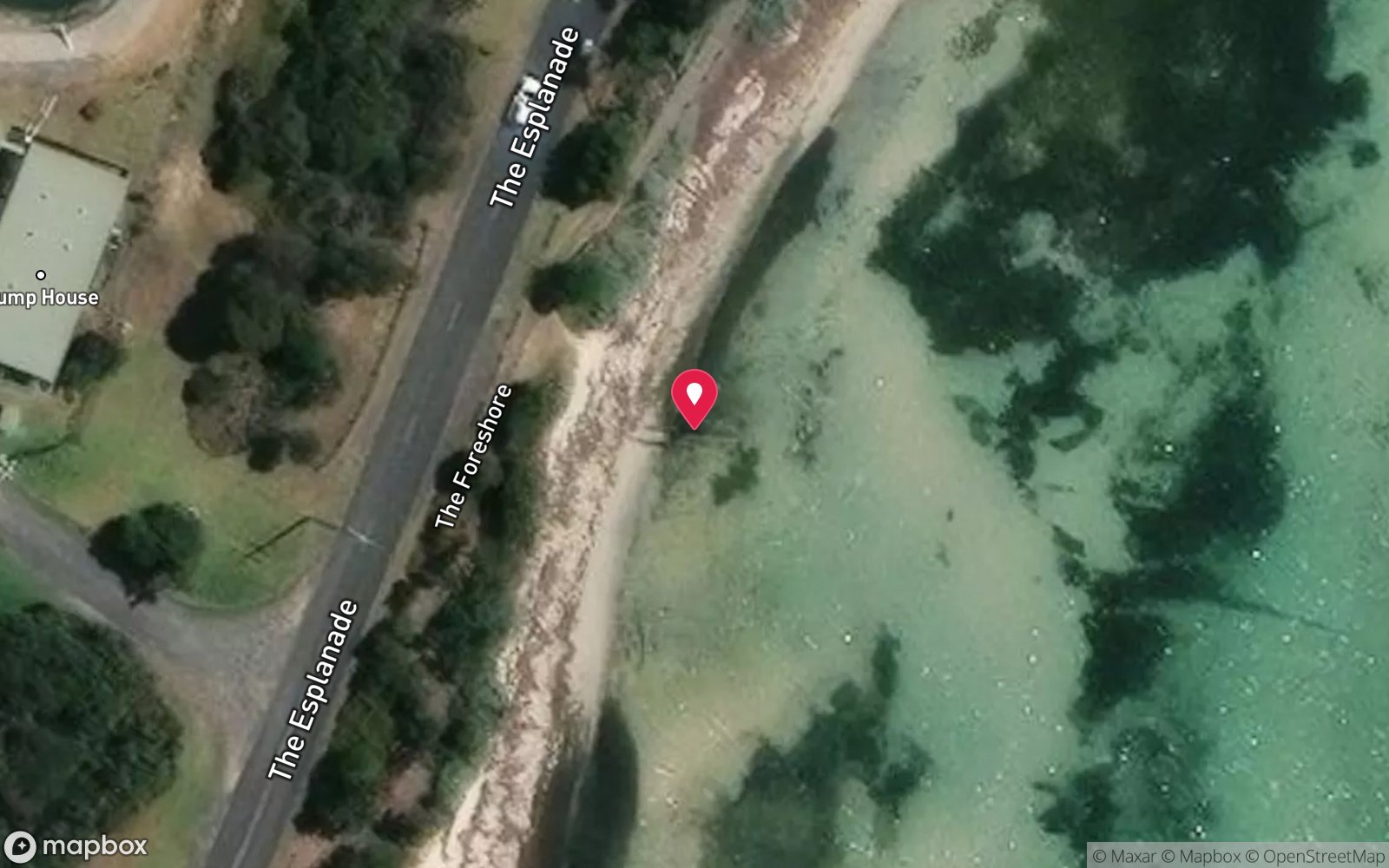
On the sand about 1 km off St Leonards on the Bellarine Peninsula inside Port Phillip, in 5 m, within a 100 m historic shipwreck protected zone.
Boat only and permit only. St Leonards boat ramp (Murradoc Road/The Esplanade) is the nearest launch, five minutes from the wreck; Queenscliff is 15 km south. Drive Melbourne–St Leonards via the Geelong Ring Road and Bellarine Highway (about 1 h 40 min).
The wreck lies inside a 100 m radius protected zone in which anchoring is prohibited and diving requires a Heritage Victoria permit; the permitted dives that have been run (Heritage Victoria, the Maritime Archaeology Association of Victoria, Flinders University field schools) use a live boat and a marker placed by the supervisor. On a clear day the outline of the hull is visible from the surface.
Entry: Permit only – descent from a live boat outside the 100 m zone; no anchoring
Facilities: St Leonards boat ramp (parking, toilets); shops in St Leonards
Weather, swell & tides
The Bellarine's eastern shore is sheltered from swell but open to northerly, easterly and south-easterly winds across the bay, which chop the shallow water and stir the sand over the wreck; westerlies are offshore and give the flattest, clearest conditions. Visibility is 3–8 m and is best in cooler months after dry weather. Tidal streams are mild this far from The Heads and the site can be dived at any tide, though a flood brings cleaner water.
Boat traffic from St Leonards and Indented Head is heavy on summer weekends.
Best season: Calm days in autumn and winter; any tide
If it's blown out
Sheltered or shore sites within 25 km that often work when Clarence doesn't.
- Chinamans Hat · 9 km · Max 12 m
- Portsea Pier · 13 km · Max 7 m
- Blairgowrie Pier · 18 km · Max 7 m
- Rye Pier · 20 km · Max 7 m
How the dive is usually run
Permitted dives only: descend outside the hull in 5 m, swim the outline of the schooner from bow to stern along the near-complete port side, note the paired frames and the Baltic pine decking, and leave without touching or fanning the sand. Excellent buoyancy is a permit condition.
Marine life
- Sand and seagrass community – flathead
- leatherjackets
- stingarees
- sea stars
- small wrasse
Linked species have their own page listing every site where they are recorded. All marine life →
Training required
Shallow enough for snorkellers and for a first dive under supervision. Any certified diver can dive it.
Courses that help here
- Drysuit Diver – Cold water; locals dive dry for much of the year.
- Peak Performance Buoyancy – Silt and low visibility punish poor trim.
Depth tiers: 0–10 m easy · to 18 m Open Water · 18–30 m Advanced (25 m+ is a deep dive) · 30–40 m Deep specialty · 40 m+ technical. All courses
Hazards & warnings
Protected zone – Heritage Victoria permit required, anchoring prohibited within 100 m, severe penalties; fragile exposed timbers – no contact; boat traffic; wind chop and poor visibility in onshore winds.
Dive centres that go here
Permit only. Dived under Heritage Victoria permit by archaeological teams (Maritime Archaeology Association of Victoria, university field schools) and on rare supervised public heritage dives; no charter schedules it.
Operators recorded for Clarence
Scubabo Dive Victoria (Queenscliff)
ListedQueenscliff · Geelong & Bellarine · VIC
A Queenscliff operation, strategically located for access toward Port Phillip Heads.
dive.scubabo.com · (03) 5258 1188
Divein2Scuba (Geelong Dive Centre)
ListedGeelong · Geelong & Bellarine · VIC
A Geelong business providing training, equipment and local diving support.
divein2scuba.com · (03) 5221 3342
Maritime Archaeology Association of Victoria
Named by sitesMelbourne & Port Phillip Bay · VIC
Volunteer maritime archaeology association, not a dive operator; site now at maav.net.au.
maav.net.au
Other dive centres in Melbourne & Port Phillip Bay
The Scuba Doctor
ProfiledRye · Melbourne & Port Phillip Bay · VIC
A Victorian equipment and service business with an extensive retail presence, located to serve both Melbourne and Mornington Peninsula divers.
scubadoctor.com.au · (03) 5985 3322
Diveline Scuba Centre
ListedFrankston · Melbourne & Port Phillip Bay · VIC
A Victorian business associated with technical training and gas support alongside recreational courses.
diveline.com.au · (03) 9783 7166
Aquability
ListedMordialloc · Melbourne & Port Phillip Bay · VIC
A Victorian operation associated with technical diving training. Exact agency, course levels and gas support require verification.
aquability.com.au · (03) 9587 1811
Bay City Scuba
ListedEast Geelong · Melbourne & Port Phillip Bay · VIC
A Victorian business associated with recreational and technical training alongside equipment and gas services.
baycityscuba.com · (03) 5248 1488
Scuba Culture
ListedBurwood · Melbourne & Port Phillip Bay · VIC
A Melbourne business providing training and equipment support for local divers.
scubaculture.com.au · (03) 9808 0033
Ocean Divers
ListedBentleigh East · Melbourne & Port Phillip Bay · VIC
A Victorian operation associated with recreational and technical training and access to Port Phillip diving.
oceandivers.com.au · (03) 9579 2600
Map
7 pinned sites. Pins marked approximate on their pages show the general area only; not for navigation.
Satellite views
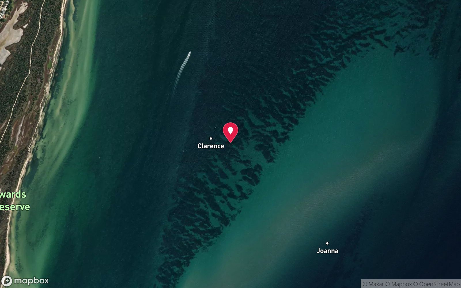
Clarence: frequently asked questions
How deep is Clarence?
Clarence reaches a maximum depth of 5 m, with the shallowest part at about 4 m; most of the dive is spent around 5 m.
What certification do I need to dive Clarence?
Open Water is the recommended minimum. Rated beginner: sheltered, shallow and manageable for a newly certified diver on a normal day, though note boat traffic overhead and cold water.
Can I shore dive Clarence?
No, it is reached by boat (about 5 minutes). A dive centre is required: permit/guide required.
When is the best time to dive Clarence?
Calm days in autumn and winter; any tide.
What marine life will I see at Clarence?
Regularly recorded: Sand and seagrass community – flathead, leatherjackets, stingarees, sea stars, small wrasse.
What wetsuit do I need at Clarence?
7 mm wetsuit or semi-dry with hood in summer; drysuit in winter.
How cold is the water at Clarence?
Typically 18-21 °C in summer and 10-13 °C in winter.
What are the main hazards at Clarence?
Protected zone – Heritage Victoria permit required, anchoring prohibited within 100 m, severe penalties; fragile exposed timbers – no contact; boat traffic; wind chop and poor visibility in onshore winds. See the hazards section above for the full list.
Where is the nearest recompression chamber to Clarence?
The Alfred (Melbourne). In an emergency call 000, then DAN Asia-Pacific on 1800 088 200.
Diving in Melbourne & Port Phillip Bay
Melbourne's bayside suburbs, from Williamstown around to Frankston, have shallow, easy shore dives: Ricketts Point Marine Sanctuary, Black Rock, Half Moon Bay and the Cerberus wreck, Frankston pier, and the artificial reefs and scuttled boats off St Kilda and Mordialloc. Visibility is modest but the life, especially at night, is good.
Getting there: Suburban shore dives with parking; charters from St Kilda and Mordialloc for the bay wrecks.
All Melbourne & Port Phillip Bay dive sites and a suggested itinerary →
Sources
- scubadoctor.com.au/divesite.htm?site=Clarence
- scubadoctor.com.au/port-phillip-heads-shipwreck-dives.htm
Data confidence: High · Being verified: Tonnage approximate. Last updated September 2026. Know this site better? How to send a correction