Dive slate · divesites.com.au · printed 9 Nov 2026
Falls of Halladale
Shipwreck Coast & Warrnambool, Victoria · near Peterborough
| Depth | 4–12 m |
|---|---|
| Minimum level | Open Water |
| Difficulty | Advanced |
| Access | Boat |
| Entry | Giant stride from a small boat anchored on sand beside the wreck; shore dive possible in calm conditions from the beach below the cliffs |
| Current | Moderate |
| Visibility | 3-12 m |
| Water | summer 16-19 °C, winter 11-14 °C |
| Suit | 7mm semi-dry with hood and gloves in summer; drysuit strongly preferred May–November |
| Best season | Autumn (Mar–May) on low swell with northerly winds |
| Bottom time | 45 min |
| Position | -38.60714, 142.85722 (GPS) |
| Permit | Protected historic shipwreck (Heritage Act 2017); Bay of Islands Coastal Park adjoins |
| Nearest chamber | The Alfred (Melbourne) |
| Emergency | 000 · DAN Asia-Pacific diving emergency 1800 088 200 |
Falls of Halladale
Also known as Falls of Halladale wreck, Peterborough wreck
The ship that stood under full sail on the reef for weeks in 1908: a 5 m high bow, lattice of iron and piles of roofing slate in 4–12 m, the best of the Peterborough wrecks.
Near Peterborough · Shipwreck Coast & Warrnambool, Victoria
- Depth
- 4–12 m
- Minimum level
- Open Water
- Access
- Boat
- Boat ride
- ~10 min
- Water
- 16-19 °C
- Visibility
- 3-12 m
Falls of Halladale4–12 m · Open Water
Dive factsDepths, conditions, location & safety
Season
Off-peak nowBest months: March, April, May.
Autumn (Mar–May) on low swell with northerly winds
- Best months
- Now (November)
Dive facts
- Depth
- 4–12 m
- Typical depth
- 8 m
- Certification
- Open Water
- Difficulty
- Advanced
- Depth tier
- Open Water (10–18 m)
- Access
- Boat
- Offshore
- 0.2 km
- Dive centre needed
- Yes – boat access only
- Shore / independent
- Possible (experienced only)
- Boat ride
- ~10 min
- Current
- Moderate
- Visibility
- 3-12 m
- Water temp (summer)
- 16-19 °C
- Water temp (winter)
- 11-14 °C
- Water
- Temperate
- Bottom time
- 45 min
- Dive traffic
- Rarely dived (private boat/club only)
- Night dive
- No
- Snorkel friendly
- No
Exposure suit
7mm semi-dry with hood and gloves in summer; drysuit strongly preferred May–November
Location
Peterborough / Bay of Islands · Shipwreck Coast – Peterborough
-38.60714, 142.85722
Published GPS position.
Open in Google MapsPrimary source: scubadoctor.com.auMarine park & permits
Protected historic shipwreck (Heritage Act 2017); Bay of Islands Coastal Park adjoins
Nearest recompression chamber
The Alfred (Melbourne)
Diving emergency: call 000, then DAN AP 1800 088 200.
Trip planner
Build a trip around Falls of Halladale →
A day-by-day plan for Shipwreck Coast & Warrnambool with this site locked in.
This guide is a planning aid. Conditions change daily — confirm with a local dive centre and dive within your training. Data & safety notes.
Dive profile
How this site rates
Scores are computed from the recorded data, not opinions. How?
At a glance
Falls of Halladale is a wreck shore dive for experienced divers in Shipwreck Coast & Warrnambool, VIC, 4–12 m, suited to Open Water divers, moderate current, about 10 minutes by boat.
Rated advanced because of surge on the entry or in the shallows, cold water.
Why dive here
- The ship that stood under full sail on the reef for weeks in 1908: a 5 m high bow, lattice of iron and piles of roofing slate in 4–12 m, the best of the Peterborough wrecks.
- Sunk in 1908 (Four-masted iron barque, 2,085 tons, c. 84 m (275 ft)); protected as underwater cultural heritage, so look but do not touch.
- Rarely dived: expect to have the site to yourself, and plan your own logistics.
About Falls of Halladale
The Falls of Halladale was a four-masted iron barque of 2,085 tons, built by Russell and Co at Greenock in 1886 for the Glasgow Falls Line and designed to carry bulk cargo fast under sail. On 14 November 1908, 102 days out from New York for Melbourne with 28 crew and a general cargo that included 22,000 roofing slates, coils of wire, corrugated iron and benzine, her master was confused by sea mist and a compass error and put her onto a submerged reef about 200 yards off the cliffs west of Peterborough at full sail. All hands got away in the boats. What made the wreck famous was that she stayed upright, canvas set, on the reef for weeks, drawing crowds from Melbourne by train and coach; photographs of the ship standing under sail in the surf became the iconic image of the Shipwreck Coast. She eventually broke up in storms, and between 1974 and 1986 divers salvaged around 22,000 slates, many of which now roof the buildings at Flagstaff Hill Maritime Museum in Warrnambool.
The wreck today appears, in the Scuba Doctor's phrase, as a complex lattice of iron beams and hull plates. The port side of the hull stands upright with 5–6 m of structure at the bow tapering to 2–3 m at the stern; the starboard side has flattened outward and the masts lie scattered to the east. Anchors, bollards, the windlass and heavy structural iron mark the bow, and at the stern are piles of slate and coiled wire from the cargo, with iron knees and plates everywhere between. Depths run from 4 m over the highest structure to about 12 m on the sand alongside, making this the most substantial and most diveable of the three Peterborough wrecks. Kelp and encrusting growth cover the iron, crayfish and abalone shelter in it, and wrasse, sweep and leatherjackets school over it. The limiting factor, as always here, is the flanking reef that breaks in anything but calm seas. It is a protected historic shipwreck on the Great Ocean Road Historic Shipwreck Trail, with an interpretive sign on the clifftop, and it suits Open Water divers with experience of surge who can find a boat on the right day.
Wreck details
Four-masted iron barque, 2,085 tons, c. 84 m (275 ft) · Sunk 1908 · Protected historic shipwreck
Era: early 20th century. Oldest wrecks · Wartime wrecks · Scuttled warships
Other wrecks of the same era
Getting there & entry
Four-masted iron barque wrecked in 1908 about 200 m off the cliffs 2–3 km north-west of Peterborough toward the Bay of Martyrs, lying as a lattice of iron in 4–12 m.
Peterborough is 50 km east of Warrnambool on the Great Ocean Road. Boats launch at the Peterborough Bay of Islands (Boat Bay) ramp off Boat Bay Road or the Curdies River ramp at the end of Dorey Street in Peterborough; the river ramp requires crossing the Curdies Inlet bar, which is only possible at higher tides and in small swell. From the Boat Bay ramp the wreck is only 1–2 km to the east, a five-minute run; from the river ramp allow 10–15 minutes and a bar crossing.
The Scuba Doctor notes a shore dive is possible in calm conditions – there is limited roadside parking on the Great Ocean Road above the site and a scramble down to the beach – but the surf normally makes the boat the only sensible option. The wreck lies about 200 m offshore, flanked by a reef that breaks in all but the calmest conditions.
Entry: Giant stride from a small boat anchored on sand beside the wreck; shore dive possible in calm conditions from the beach below the cliffs
Facilities: Peterborough boat ramps, toilets and picnic area at Boat Bay, general store and pub; Flagstaff Hill Maritime Museum in Warrnambool displays the slates and artefacts; no air fills nearer than Warrnambool.
Weather, swell & tides
Best dived on a low swell with northerly winds. The site is flanked by a reef which causes heavy breaks in all but the calmest conditions, so the practical limit is a south-west swell under about 0.8 m; southerly and south-easterly seas break right across the wreck. A northerly of any strength flattens the inshore water and clears the visibility within a day or two.
If launching from the Curdies River, plan around the bar. Morning is better than afternoon. Perhaps ten to fifteen diveable days a year, which still makes it the most accessible of the Peterborough wrecks.
Best season: Autumn (Mar–May) on low swell with northerly winds
If it's blown out
Sheltered or shore sites within 25 km that often work when Falls of Halladale doesn't.
- Bay of Martyrs · 1 km · Max 10 m
- Schomberg · 3 km · Max 10 m
- Newfield · 4 km · Max 7 m
- Antares · 10 km · Max 6 m
How the dive is usually run
Anchor on sand seaward of the wreck, descend to 10–12 m and swim to the bow, where the port side stands 5–6 m high. Follow the port hull aft along the lattice of beams and plates, noting the anchors, bollards and windlass forward and the slate and coiled wire at the stern, then cross to the flattened starboard side and the scatter of masts to the east. Turn at half gas, return to the anchor and ascend the line.
Marine life
- Southern rock lobster
- black-lip abalone
- blue-throat wrasse
- sea sweep
- leatherjackets
- zebrafish
- kelp and encrusting sponges on the iron
- rays on the sand
Linked species have their own page listing every site where they are recorded. All marine life →
Training required
Within the 18 m limit of an entry-level certification.
Courses that help here
- Drysuit Diver – Cold water; locals dive dry for much of the year.
Depth tiers: 0–10 m easy · to 18 m Open Water · 18–30 m Advanced (25 m+ is a deep dive) · 30–40 m Deep specialty · 40 m+ technical. All courses
Hazards & warnings
Flanking reef breaks heavily in anything but calm seas; exposed to southerly swell; surge; sharp iron; Curdies Inlet bar if used; boat should stand off with someone aboard. Protected historic shipwreck – no artefact removal.
Dive centres that go here
No regular operator – Warrnambool Diving, Melbourne clubs and private boats on calm autumn days; the site is the most-dived of the Peterborough wrecks because it is closest to the Boat Bay ramp.
Operators recorded for Falls of Halladale
Other dive centres in Shipwreck Coast & Warrnambool
Daktari Sport (Daktari Surf & Dive)
Named by sitesPort Fairy · Shipwreck Coast & Warrnambool · VIC
Website live for 2026 with current PADI course prices; stores in Port Fairy, Hamilton and Mount Gambier.
daktarisport.com.au
Port Campbell Boat Charters
Named by sitesPort Campbell · Shipwreck Coast & Warrnambool · VIC
Listed at 32 Lord St Port Campbell offering scenic, fishing, snorkelling and diving trips; a listing says tours were suspended for pier maintenance and current status is unconfirmed.
portcampbellboatcharters.com.au · 0428 986 366
Map
7 pinned sites. Pins marked approximate on their pages show the general area only; not for navigation.
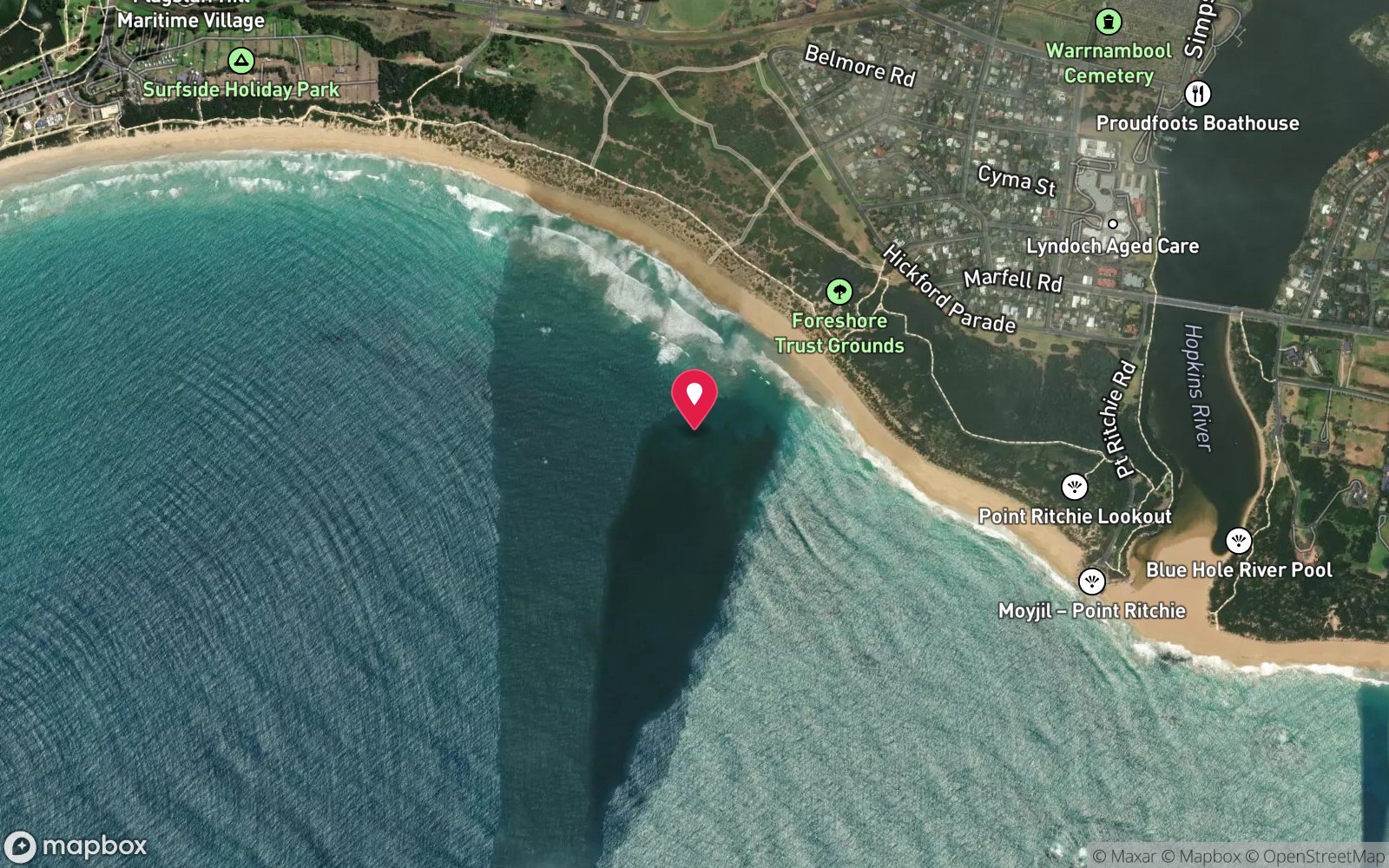
Satellite views
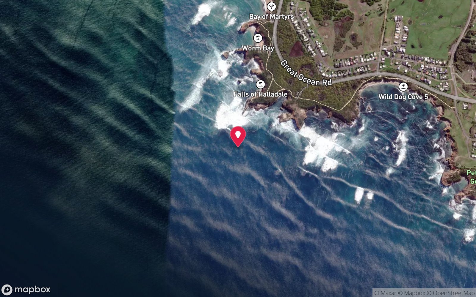
Falls of Halladale: frequently asked questions
How deep is Falls of Halladale?
Falls of Halladale reaches a maximum depth of 12 m, with the shallowest part at about 4 m; most of the dive is spent around 8 m.
What certification do I need to dive Falls of Halladale?
Open Water is the recommended minimum. Rated advanced because of surge on the entry or in the shallows, cold water.
Can I shore dive Falls of Halladale?
Experienced divers do dive Falls of Halladale from the shore, but the entry or conditions make it unsuitable for newer divers without local guidance. Entry: Giant stride from a small boat anchored on sand beside the wreck; shore dive possible in calm conditions from the beach below the cliffs.
When is the best time to dive Falls of Halladale?
Autumn (Mar–May) on low swell with northerly winds.
What marine life will I see at Falls of Halladale?
Regularly recorded: Southern rock lobster, black-lip abalone, blue-throat wrasse, sea sweep, leatherjackets, zebrafish, kelp and encrusting sponges on the iron, rays on the sand.
What wetsuit do I need at Falls of Halladale?
7mm semi-dry with hood and gloves in summer; drysuit strongly preferred May–November.
How cold is the water at Falls of Halladale?
Typically 16-19 °C in summer and 11-14 °C in winter.
What are the main hazards at Falls of Halladale?
Flanking reef breaks heavily in anything but calm seas; exposed to southerly swell; surge; sharp iron; Curdies Inlet bar if used; boat should stand off with someone aboard. See the hazards section above for the full list.
Where is the nearest recompression chamber to Falls of Halladale?
The Alfred (Melbourne). In an emergency call 000, then DAN Asia-Pacific on 1800 088 200.
Diving in Shipwreck Coast & Warrnambool
The coast between Cape Otway and Port Fairy earned its name honestly: the Loch Ard, the Falls of Halladale, the Schomberg and dozens of others lie in the shallows below the limestone cliffs. Warrnambool's Breakwater, Port Fairy's Griffiths Island and the Lady Bay reefs are dived on the rare days of nil swell, and Julia Percy Island has fur seals.
Getting there: Three to four hours west of Melbourne along the Great Ocean Road. Shore dives at Warrnambool and Port Fairy; local club boat dives.
All Shipwreck Coast & Warrnambool dive sites and a suggested itinerary →
Sources
- scubadoctor.com.au/divesite.htm?site=Falls-of-Halladale
- scubadoctor.com.au/west-coast-shipwreck-trail.htm
- en.wikipedia.org/wiki/Falls_of_Halladale
Data confidence: Medium · Being verified: Maximum depth quoted as 12 m and 18 m on the same page; v1 said 10 m.. Last updated September 2026. Know this site better? How to send a correction