Dive slate · divesites.com.au · printed 9 Nov 2026
USAT Meigs
Darwin Harbour, Northern Territory · near Darwin
| Depth | Max 18 m |
|---|---|
| Minimum level | Open Water |
| Difficulty | Intermediate |
| Access | Boat (day trip) |
| Entry | Giant stride or backward roll from the boat; descend the shot or anchor line |
| Current | Variable/Tidal |
| Visibility | 2-8 m |
| Water | summer 29-32 °C, winter 24-26 °C |
| Suit | 3 mm wetsuit or skin in the dry season; full-length Lycra stinger suit (with hood and gloves) October-May |
| Best season | May-October (dry season), on neap tides only |
| Bottom time | 40 min |
| Position | -12.48767, 130.81833 (approximate) |
| Permit | Protected under the NT Heritage Act 2011 and the Commonwealth Underwater Cultural Heritage Act 2018 (wreck over 75 years old): look but do not touch, no artefact removal or disturbance. Check with the NT Heritage Branch (08 8999 5039, heritage.branch@nt.gov.au) for any current permit or protected-zone conditions. |
| Nearest chamber | Royal Darwin Hospital hyperbaric medicine unit (Tiwi, Darwin) |
| Emergency | 000 · DAN Asia-Pacific diving emergency 1800 088 200 |
USAT Meigs
Also known as USS Meigs, US Army Transport Meigs
The largest ship sunk in the 1942 raid, with a Bren gun carrier in the bow, trucks, railway iron and ammunition dumps still on the seabed.
Near Darwin · Darwin Harbour, Northern Territory
- Depth
- Max 18 m
- Minimum level
- Open Water
- Access
- Boat (day trip)
- Boat ride
- —
- Water
- 29-32 °C
- Visibility
- 2-8 m
USAT MeigsMax 18 m · Open Water
Dive factsDepths, conditions, location & safety
Season
Off-peak nowBest months: May, June, July, August, September, October.
May-October (dry season), on neap tides only
- Best months
- Now (November)
- Stinger suit Nov–May
Dive facts
- Depth
- Max 18 m
- Typical depth
- 18 m
- Certification
- Open Water
- Difficulty
- Intermediate
- Depth tier
- Open Water (10–18 m)
- Access
- Boat (day trip)
- Dive centre needed
- Yes – boat access only
- Shore / independent
- No
- Current
- Variable/Tidal
- Visibility
- 2-8 m
- Water temp (summer)
- 29-32 °C
- Water temp (winter)
- 24-26 °C
- Water
- Tropical
- Bottom time
- 40 min
- Dive traffic
- Popular (weekly charters)
- Night dive
- Possible
- Snorkel friendly
- No
Exposure suit
3 mm wetsuit or skin in the dry season; full-length Lycra stinger suit (with hood and gloves) October-May
Location
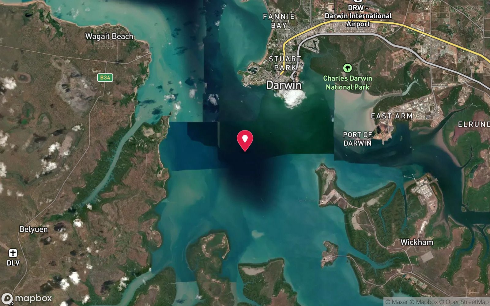
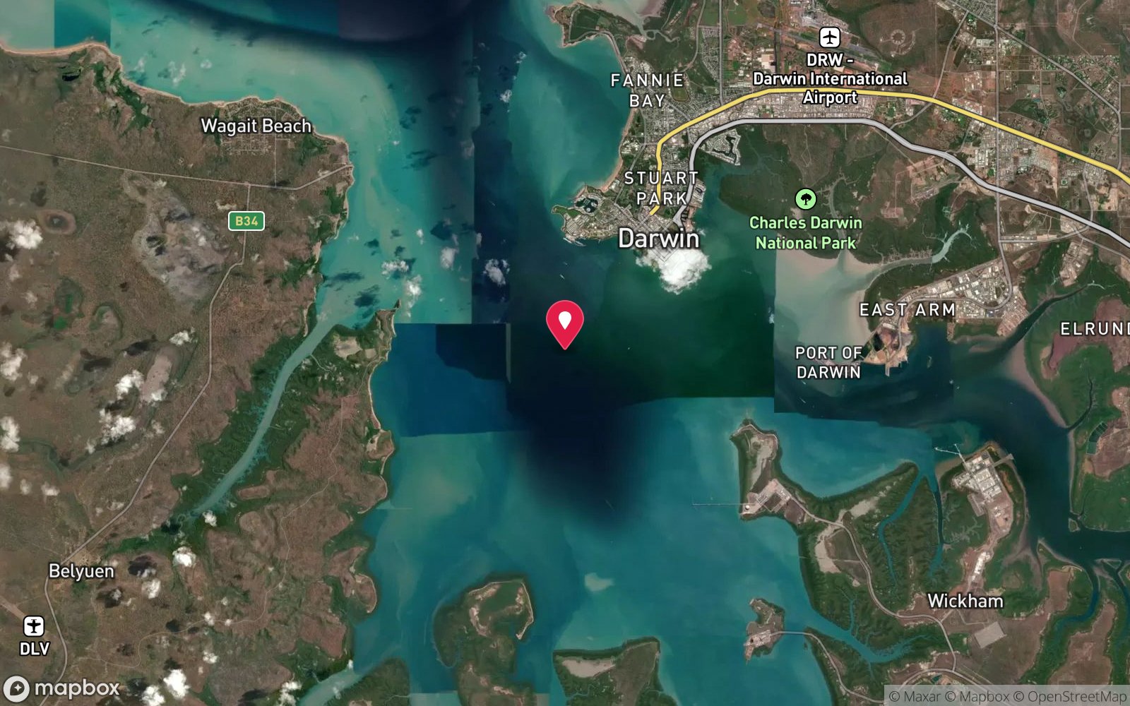
Inner harbour - southern anchorage
-12.48767, 130.81833
Approximate position — not for navigation.
Open in Google MapsDive site map (external) →Primary source: dsac.com.auMarine park & permits
Protected under the NT Heritage Act 2011 and the Commonwealth Underwater Cultural Heritage Act 2018 (wreck over 75 years old): look but do not touch, no artefact removal or disturbance. Check with the NT Heritage Branch (08 8999 5039, heritage.branch@nt.gov.au) for any current permit or protected-zone conditions.
Nearest recompression chamber
Royal Darwin Hospital hyperbaric medicine unit (Tiwi, Darwin)
Diving emergency: call 000, then DAN AP 1800 088 200.
Trip planner
Build a trip around USAT Meigs →
A day-by-day plan for Darwin Harbour with this site locked in.
This guide is a planning aid. Conditions change daily — confirm with a local dive centre and dive within your training. Data & safety notes.
Dive profile
How this site rates
Scores are computed from the recorded data, not opinions. How?
At a glance
USAT Meigs is a wreck boat dive in Darwin Harbour, NT, to a maximum of 18 m, suited to Open Water divers, variable/tidal current.
Rated intermediate because of tidal current that must be timed, boat traffic overhead.
Why dive here
- The largest ship sunk in the 1942 raid, with a Bren gun carrier in the bow, trucks, railway iron and ammunition dumps still on the seabed.
- Sunk in 1942 (US Army transport, 131 m (430 ft), 12,568 GRT); protected as underwater cultural heritage, so look but do not touch.
Conditions to avoid
- Strong southerly or south-east swell and wind
- Outgoing tide or run-off after rain (poor visibility)
- Spring tides (strong current)
- Any time other than slack water
- Cyclone season (roughly December–April)
About USAT Meigs
The Meigs was the biggest ship in Darwin Harbour on 19 February 1942 and remains the largest and most rewarding of the raid wrecks. Built in 1921 by the Los Angeles Shipbuilding and Dry Dock Company at San Pedro, California, she was a 131 m, 12,568-ton US Army transport with a straight stem, counter stern, two decks and three masts. She had come to Darwin with a convoy carrying troops and supplies intended for the relief of Portuguese Timor.
During the raid she was hit by numerous bombs, machine-gunned and finally struck by aerial torpedoes; remarkably only one or two of her 66 crew were killed. After the raid her masts could still be seen above the water. The 19 February 1942 raids - two waves of Japanese carrier and land-based aircraft, the first and heaviest attack ever made on mainland Australia - sank eight ships in the harbour and killed more than 230 people.
In 1959-60 the Japanese firm Fujita Salvage cut most of the wrecks down to or below the waterline for scrap, so what divers find today is usually the lower hull, machinery that was too heavy to lift, and the cargo that the salvors were not permitted to remove. Fujita cut the Meigs off at the waterline around 1960 but was not allowed to take the American-owned cargo, and that is what makes the dive. The wreck lies roughly north-south in about 18 m and is a vast jumble of steel on a silty bottom.
A Bren gun carrier is recognisable in the bow, military trucks lie mostly buried in the holds, lengths of railway iron cross the midships section and piles of rifle ammunition lie in dumps. Gorgonian fans and sponges cover parts of the structure. Local divers reckon it takes about three dives to see it properly, and it rewards repeat visits as the sand shifts and exposes different cargo.
Its moderate depth makes it the best introduction to Darwin's WWII wreck diving for divers who can cope with low visibility, and Darwin Dive Centre notes that Open Water certification is adequate for most of the harbour wrecks when conditions are good.
The ship and the sinking
The Meigs was a United States Army transport of 12,500 tons, built in 1921 as the West Lewark and renamed for Quartermaster General Montgomery Meigs. In February 1942 she was in Darwin Harbour, having been turned back from Timor with the convoy carrying reinforcements for the island, still loaded with trucks, Bren gun carriers, railway iron and ammunition.
On the morning of 19 February 1942 the first Japanese air raid on Australia hit the harbour with 188 aircraft. The Meigs was bombed and set on fire, and sank that afternoon in 18 m, the largest ship lost in the raid; two of her crew died. Eight ships were sunk in the harbour that morning and more than 230 people killed.
What is there today
She lies on her side in 18 m and is the signature wreck of Darwin Harbour, dived on the neap-tide slack when the current stops and the visibility rises to 5–10 m. The Bren carrier in the bow, trucks in the holds and the railway iron are all still there. She is protected under the Underwater Cultural Heritage Act, and nothing may be removed.
Wrecks older than 75 years, and several younger ones, are protected under the Underwater Cultural Heritage Act 2018: look, photograph, take nothing. Australia's oldest wreck dives →
Wreck details
US Army transport, 131 m (430 ft), 12,568 GRT · Sunk 1942 · Protected historic shipwreck
Era: Second World War. Oldest wrecks · Wartime wrecks · Scuttled warships
Other wrecks of the same era
- SS Mauna Loa · Max 20 m · Darwin Harbour
- SS Zealandia · Max 22 m · Darwin Harbour
- British Motorist · Max 20 m · Darwin Harbour
- Don Isidro · Depth not published · Tiwi Islands
- Florence D · Max 16 m · Tiwi Islands
- Japanese Submarine I-124 · Max 45 m · Darwin Offshore & Artificial Reefs
Getting there & entry
Southern part of Darwin Harbour's main anchorage, about 3 km from the Darwin wharf and roughly 1 km from the Mauna Loa.
Boat only. Darwin's charter operators leave from Cullen Bay Marina or the Darwin Waterfront precinct and run across the harbour to the site in well under half an hour on a calm neap-tide morning. Private boats can launch at the Cullen Bay public ramp (west of the CBD off Marina Boulevard), the Stokes Hill / Frances Bay ramp beside the Waterfront, or the East Arm ramp for the southern anchorage.
Mark the position on GPS before the dive - the wrecks lie in open water with no surface marker - and drop a shot rather than anchoring into protected structure. Parking and trailer bays are at all three ramps; air fills and hire through the Darwin dive shops.
Entry: Giant stride or backward roll from the boat; descend the shot or anchor line
Weather, swell & tides
Tide is everything in Darwin Harbour: the spring range is 7-8 m and tidal streams run hard through the harbour, so diving is generally only possible on neap tides (range under about 3-4 m), timed to the slack at high water when clearer ocean water sits over the site. Spring tides bring strong currents and silt-laden water with near-zero visibility. The dry season (May-October) gives the most consistent conditions; the south-east trade winds can chop up exposed water in the afternoon, so mornings are best.
In the wet season (November-April) run-off from the rivers and creeks drops visibility, afternoon storms build quickly, and the harbour is in cyclone season; box jellyfish are present October-May.
Best season: May-October (dry season), on neap tides only
If it's blown out
Sheltered or shore sites within 25 km that often work when USAT Meigs doesn't.
- NR Diemen · 8 km · Max 12 m
- Stokes Hill Wharf Artificial Reef · 4 km · Max 10 m
- MV Neptuna remnants · 4 km · Max 10 m
- Mandorah Jetty · 8 km · Depth not published
How the dive is usually run
Descend the shot at neap slack and orient to the north-south line of the wreck. Plan several dives to cover it: one on the bow to find the Bren gun carrier, one along the midships railway iron, one on the stern section. Hold 15-18 m, move slowly to avoid silting, turn at half gas and return to the shot for the ascent and safety stop.
Marine life
- Estuary cod
- golden snapper
- black jewfish
- barracuda
- angelfish
- batfish
- trevally
- lionfish
- sea snakes
- gorgonian fans and sponges
Linked species have their own page listing every site where they are recorded. All marine life →
Training required
Within the 18 m limit of an entry-level certification.
Courses that help here
- Peak Performance Buoyancy – Silt and low visibility punish poor trim.
Depth tiers: 0–10 m easy · to 18 m Open Water · 18–30 m Advanced (25 m+ is a deep dive) · 30–40 m Deep specialty · 40 m+ technical. All courses
Hazards & warnings
Darwin's tidal range reaches 7-8 m on springs: dive only on neap tides at slack water or currents become unswimmable and visibility collapses. Saltwater crocodiles live throughout the harbour - keep surface intervals short, no dangling legs, keep a lookout at entry and exit. Box jellyfish (Chironex) and Irukandji October-May - full-length stinger suit, hood and gloves, vinegar on board.
Silt is fine and easily stirred. Commercial shipping, ferries and tugs use the harbour: fly the dive flag, use an SMB on ascent and keep a boat cover. Sharp cut steel and cargo edges.
Ammunition on the wreck may be live - do not handle.
Dive centres that go here
Darwin Dive Centre and Dive Darwin run harbour wreck charters only on neap-tide windows (typically a few days either side of each neap, weekends favoured); Darwin Sub Aqua Club dives it on club neap-tide days (members plan dives at Thursday meetings at the Darwin Ski Club). No daily schedule.
Operators recorded for USAT Meigs
Dive Darwin
ProfiledDarwin · Darwin Harbour · NT
The main verified dive operation in the Northern Territory, offering recreational training through professional level alongside technical diving and a large specialty range.
divedarwin.com.au · +61 401 751 651
Darwin Sub Aqua Club
Named by sitesDarwin · Darwin Harbour · NT
Club, not a shop: official site updated August 2026 with the 2026 AGM notice; meets Thursdays at Darwin Ski Club, Fannie Bay.
dsac.com.au
Map
7 pinned sites. Pins marked approximate on their pages show the general area only; not for navigation.
Satellite views
USAT Meigs: frequently asked questions
How deep is USAT Meigs?
USAT Meigs reaches a maximum depth of 18 m; most of the dive is spent around 18 m.
What certification do I need to dive USAT Meigs?
Open Water is the recommended minimum. Rated intermediate because of tidal current that must be timed, boat traffic overhead.
Can I shore dive USAT Meigs?
No, it is reached by boat. A dive centre is required: boat access only.
When is the best time to dive USAT Meigs?
May-October (dry season), on neap tides only.
What marine life will I see at USAT Meigs?
Regularly recorded: Estuary cod, golden snapper, black jewfish, barracuda, angelfish, batfish, trevally, lionfish, sea snakes, gorgonian fans and sponges.
What wetsuit do I need at USAT Meigs?
3 mm wetsuit or skin in the dry season; full-length Lycra stinger suit (with hood and gloves) October-May.
How cold is the water at USAT Meigs?
Typically 29-32 °C in summer and 24-26 °C in winter.
What are the main hazards at USAT Meigs?
Darwin's tidal range reaches 7-8 m on springs: dive only on neap tides at slack water or currents become unswimmable and visibility collapses. See the hazards section above for the full list.
Where is the nearest recompression chamber to USAT Meigs?
Royal Darwin Hospital hyperbaric medicine unit (Tiwi, Darwin). In an emergency call 000, then DAN Asia-Pacific on 1800 088 200.
Diving in Darwin Harbour
Darwin Harbour is Australia's most historic wreck-diving location. The Japanese air raid of 19 February 1942 sank the USAT Meigs, SS Mauna Loa, British Motorist, Zealandia, Kelat and others, and they remain as protected war graves in 15–25 m, along with the Song Saigon refugee boat and a scatter of barges and aircraft. Visibility is low (3–8 m) and the tidal range reaches 8 m, so every dive is planned around slack water on the neap tides.
Getting there: Charters from Darwin, generally advertised weeks ahead for the neap-tide windows. No shore diving.
Sources
- dsac.com.au/Divesite_files/Meigs.htm
- marinelife.org.au/?page_id=58
- en.wikipedia.org/wiki/USAT_Meigs
- abc.net.au/news/2015-12-02/ww2-wrecks-and-darwin-ice-age-history-mapped/6989224
- nt.gov.au/leisure/arts-culture-heritage/visit-a-cultural-or-heritage-site/maritime-heritage
- wikiaustralia.com/tour/darwin-dive-centre
Data confidence: High · Being verified: Coordinates from Wikipedia (12°29.26'S 130°49.10'E). Casualty figure given as 1 (Wikipedia) or 2 (DSAC).. Last updated September 2026. Know this site better? How to send a correction