Dive slate · divesites.com.au · printed 9 Nov 2026
HMS Sirius wreck site
Norfolk Island, External Territories · near Kingston / Burnt Pine
| Depth | 1–8 m |
|---|---|
| Minimum level | Open Water |
| Difficulty | Advanced |
| Access | Shore or Boat |
| Entry | Swim out from Slaughter Bay over the reef in flat calm only, or from a boat launched at Kingston Pier |
| Current | Mild |
| Visibility | 10-20 m |
| Water | summer 22-25 °C, winter 18-19 °C |
| Suit | 5 mm full suit year-round; add a hood or vest June–October |
| Best season | November–April for warmer water and lighter winds; winter can give 40 m visibility but more days lost to wind |
| Bottom time | 40 min |
| Position | -29.06030, 167.95500 (approximate) |
| Permit | Protected historic shipwreck (Underwater Cultural Heritage Act 2018; declared 1984); National and Commonwealth Heritage Listed (2011); Norfolk Marine Park – Slaughter Bay no-take area |
| Nearest chamber | Prince of Wales Hospital (Randwick, Sydney) – about 1,700 km; no chamber on Norfolk Island, aeromedical evacuation from Norfolk Island Airport via the Norfolk Island Health service (Auckland may be used – confirm) |
| Emergency | 000 · DAN Asia-Pacific diving emergency 1800 088 200 |
HMS Sirius wreck site
Also known as Sirius, HMS Sirius (1790)
The remains of the First Fleet flagship, lost off Slaughter Bay in 1790 – Australia's most significant colonial shipwreck.
Near Kingston / Burnt Pine · Norfolk Island, External Territories
- Depth
- 1–8 m
- Minimum level
- Open Water
- Access
- Shore or Boat
- Boat ride
- ~5 min
- Water
- 22-25 °C
- Visibility
- 10-20 m
HMS Sirius wreck site1–8 m · Open Water · Shore
Dive factsDepths, conditions, location & safety
Season
In season nowBest months: January, February, March, April, June, July, August, November, December.
November–April for warmer water and lighter winds; winter can give 40 m visibility but more days lost to wind
- Best months
- Now (November)
- Stinger suit Nov–May
Dive facts
- Depth
- 1–8 m
- Typical depth
- 4 m
- Certification
- Open Water
- Difficulty
- Advanced
- Depth tier
- Easy (0–10 m)
- Access
- Shore or Boat
- Offshore
- 0.4 km
- Dive centre needed
- Recommended
- Shore / independent
- Possible (experienced only)
- Boat ride
- ~5 min
- Current
- Mild
- Visibility
- 10-20 m
- Water temp (summer)
- 22-25 °C
- Water temp (winter)
- 18-19 °C
- Water
- Subtropical
- Bottom time
- 40 min
- Dive traffic
- Rarely dived (private boat/club only)
- Night dive
- No
- Snorkel friendly
- Partial
Exposure suit
5 mm full suit year-round; add a hood or vest June–October
Location
Kingston – Slaughter Bay reef
-29.06030, 167.95500
Approximate position — not for navigation.
Open in Google MapsPrimary source: cosmosarch.comMarine park & permits
Protected historic shipwreck (Underwater Cultural Heritage Act 2018; declared 1984); National and Commonwealth Heritage Listed (2011); Norfolk Marine Park – Slaughter Bay no-take area
Nearest recompression chamber
Prince of Wales Hospital (Randwick, Sydney) – about 1,700 km; no chamber on Norfolk Island, aeromedical evacuation from Norfolk Island Airport via the Norfolk Island Health service (Auckland may be used – confirm)
Diving emergency: call 000, then DAN AP 1800 088 200.
Trip planner
Build a trip around HMS Sirius wreck site →
A day-by-day plan for Norfolk Island with this site locked in.
This guide is a planning aid. Conditions change daily — confirm with a local dive centre and dive within your training. Data & safety notes.
Dive profile
How this site rates
Scores are computed from the recorded data, not opinions. How?
At a glance
HMS Sirius wreck site is a wreck shore dive for experienced divers in Norfolk Island, Australia's external territories, 1–8 m, suited to Open Water divers, about 5 minutes by boat.
Rated advanced by the operators who dive it.
Why dive here
- The remains of the First Fleet flagship, lost off Slaughter Bay in 1790 – Australia's most significant colonial shipwreck.
- Sunk in 1790; protected as underwater cultural heritage, so look but do not touch.
- Rarely dived: expect to have the site to yourself, and plan your own logistics.
- Visibility often reaches 10-20 m.
Conditions to avoid
- Strong southerly or south-east swell and wind
- Any time other than slack water
About HMS Sirius wreck site
HMS Sirius is, as the Naval Historical Society puts it, Australia's equivalent of the Mayflower. She was the flagship of the First Fleet, leading eleven ships from England in 1787 to found the colony at Sydney Cove, and she was for a time the only link between the new settlements at Sydney and Norfolk Island and the outside world. Built as the merchant ship Berwick in 1780 at Rotherhithe, she was bought by the Royal Navy in 1781 after a fire, rebuilt, and rated at 511 tons with a gundeck of 110 ft 5 in (about 33.7 m) and ten guns.
On 19 March 1790, on a voyage carrying convicts, marines and children to Norfolk Island, Sirius struck the reef off Slaughter Bay while landing stores and was lost. Everyone survived, but the loss stranded the colony without its main supply vessel.
The wreck was declared a protected historic shipwreck in 1984 and added to the National and Commonwealth Heritage Lists in 2011. Archaeological work recovered three anchors and two carronades, which are displayed at the Norfolk Island Museum (the museum was established in 1988 with Bicentennial funding to display the Sirius artefacts); another anchor and a cannon stand at Macquarie Place in Sydney. Cosmos Archaeology's 2020 heritage management plan found the site relatively well preserved despite the surf, with most material still in place: mounds of cast-iron ballast pigs, anchor remains and flukes, a pump chamber, copper tacks and sheathing, musket balls and ceramics. Large sea urchin populations are a concern because they affect the iron.
For divers this is a historical pilgrimage rather than a scenic wreck. There is no hull; what remains is concrete-like ballast and fittings among the reef in a few metres of turbulent water. Conditions are the challenge: the site is diveable only on rare flat days. Look, photograph and leave everything exactly as found.
Wreck details
Royal Navy sixth-rate/armed storeship, ex-merchantman Berwick (1780); 511 tons bm; gundeck 33.7 m (110 ft 5 in); 10 guns · Sunk 1790 · Protected historic shipwreck
Era: early colonial. Oldest wrecks · Wartime wrecks · Scuttled warships
Other wrecks of the same era
- HMS Pandora wreck · Max 33 m · Far Northern Reef & Torres Strait
- Sydney Cove (Preservation Island) · Max 4 m · Flinders Island & Furneaux Group
Getting there & entry
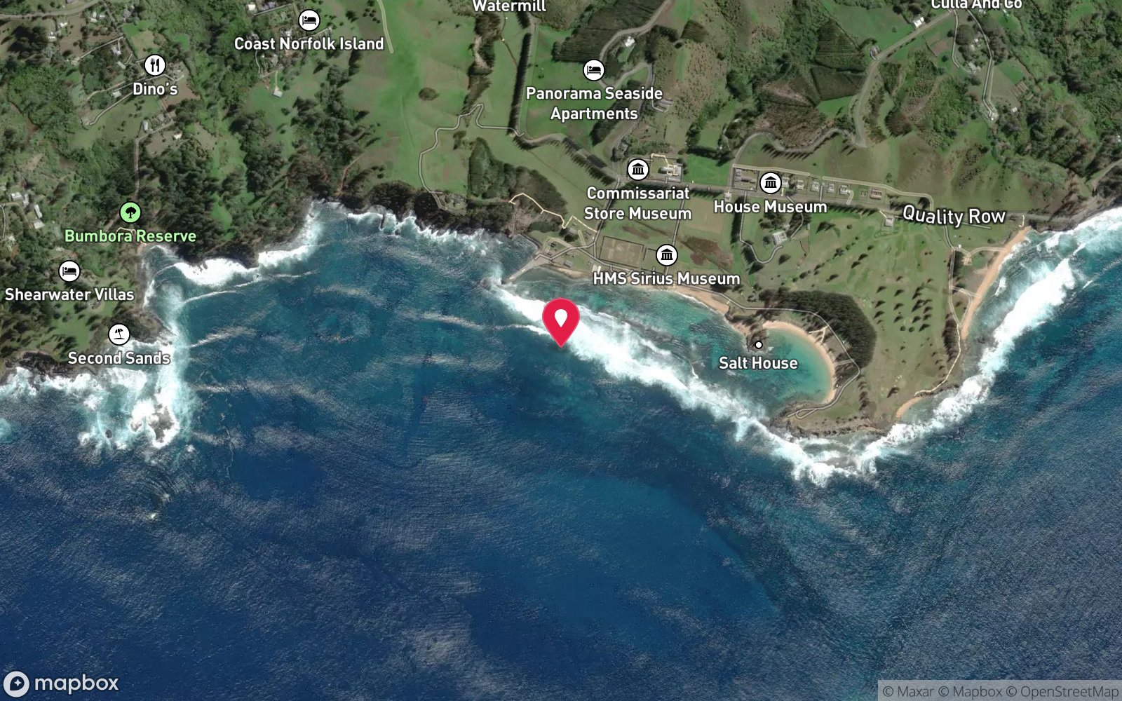
The scattered remains of HMS Sirius, flagship of the First Fleet, on the outer edge of the fringing reef off Slaughter Bay, Kingston, in a rough surf zone.
Norfolk Island is about 1,450 km east of Brisbane; flights run from Sydney and Brisbane (about 2.5 h; check the current carrier). A hire car is essential. The Sirius lies off Slaughter Bay at Kingston, about 10 minutes' drive from Burnt Pine.
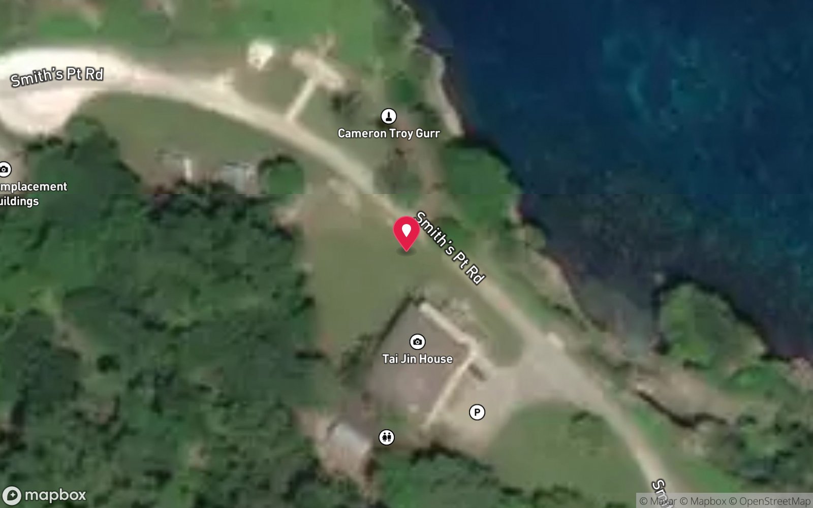
Park on Bay Street or at Kingston Pier. The site is on the seaward edge of the reef in the surf zone, reached either by a long swim across the Slaughter Bay lagoon and over the reef crest on a flat day or by boat from Kingston Pier. Talk to Norfolk Island Diving and the Norfolk Island Museum before going.
See the recovered anchors, carronades and artefacts at the HMS Sirius Museum in Kingston.
Entry: Swim out from Slaughter Bay over the reef in flat calm only, or from a boat launched at Kingston Pier
Facilities: Parking on Bay Street and at Kingston Pier; toilets at Emily Bay; HMS Sirius Museum in Kingston.
Weather, swell & tides
The wreck site is in 'a rough and turbulent surf zone' on the outer edge of the Kingston reef, fully exposed to the prevailing south-east trades and to southerly swell. It can be visited only on rare days of flat calm with northerly or no wind and no southerly groundswell – typically in summer. Even a 1 m swell breaks on the reef crest.
Currents run out through the reef channels on a falling tide. Visibility is 10–30 m when calm. Plan around a high, slack tide for the crossing.
Best season: November–April for warmer water and lighter winds; winter can give 40 m visibility but more days lost to wind
If it's blown out
Sheltered or shore sites within 25 km that often work when HMS Sirius wreck site doesn't.
- Slaughter Bay · 0 km · Max 6 m
- Emily Bay · 1 km · Max 6 m
- Cemetery Bay · 2 km · Depth not published
- Kingston Pier · 0 km · Max 12 m
How the dive is usually run
Only in flat calm, with local guidance. Cross the reef crest at the safest channel, then drift slowly over the seaward reef looking for ballast pigs, copper sheathing fragments and anchor remains wedged among the coral. Touch nothing, keep off the bottom and return before the tide turns.
Marine life
- Reef fish and corals growing over ballast and fittings; sea urchins (abundant)
Linked species have their own page listing every site where they are recorded. All marine life →
Training required
Shallow enough for snorkellers and for a first dive under supervision. Any certified diver can dive it.
Courses that help here
- Wreck Diver – The wreck has penetration options.
Depth tiers: 0–10 m easy · to 18 m Open Water · 18–30 m Advanced (25 m+ is a deep dive) · 30–40 m Deep specialty · 40 m+ technical. All courses
Hazards & warnings
Surf zone – breaking waves on the reef crest; only in flat calm; outflowing currents through the reef channels; sharp coral and reef; protected site – disturbing or removing anything is an offence; no chamber on Norfolk Island.
Technical notes
Protected under the Underwater Cultural Heritage Act 2018; confirm with the Department (DCCEEW) whether any protected zone or permit applies before diving. No penetration – no hull remains.
Dive centres that go here
No regular dive trips – visits only by arrangement with Norfolk Island Diving in rare flat-calm conditions; artefacts displayed at the Norfolk Island Museum (HMS Sirius Museum, Kingston).
Operators recorded for HMS Sirius wreck site
Other dive centres in Norfolk Island
Map
7 pinned sites. Pins marked approximate on their pages show the general area only; not for navigation.
Satellite views
HMS Sirius wreck site: frequently asked questions
How deep is HMS Sirius wreck site?
HMS Sirius wreck site reaches a maximum depth of 8 m, with the shallowest part at about 1 m; most of the dive is spent around 4 m.
What certification do I need to dive HMS Sirius wreck site?
Open Water is the recommended minimum. Rated advanced by the operators who dive it.
Can I shore dive HMS Sirius wreck site?
Experienced divers do dive HMS Sirius wreck site from the shore, but the entry or conditions make it unsuitable for newer divers without local guidance. Entry: Swim out from Slaughter Bay over the reef in flat calm only, or from a boat launched at Kingston Pier.
When is the best time to dive HMS Sirius wreck site?
November–April for warmer water and lighter winds; winter can give 40 m visibility but more days lost to wind.
What marine life will I see at HMS Sirius wreck site?
Regularly recorded: Reef fish and corals growing over ballast and fittings; sea urchins (abundant).
What wetsuit do I need at HMS Sirius wreck site?
5 mm full suit year-round; add a hood or vest June–October.
How cold is the water at HMS Sirius wreck site?
Typically 22-25 °C in summer and 18-19 °C in winter.
What are the main hazards at HMS Sirius wreck site?
Surf zone – breaking waves on the reef crest; only in flat calm; outflowing currents through the reef channels; sharp coral and reef; protected site – disturbing or removing anything is an offence; no chamber on Norfolk Island. See the hazards section above for the full list.
Where is the nearest recompression chamber to HMS Sirius wreck site?
Prince of Wales Hospital (Randwick, Sydney) – about 1,700 km; no chamber on Norfolk Island, aeromedical evacuation from Norfolk Island Airport via the Norfolk Island Health service (Auckland may be used – confirm). In an emergency call 000, then DAN Asia-Pacific on 1800 088 200.
Diving in Norfolk Island
Norfolk Island sits on its own in the Tasman Sea, and its reefs feel like it: subtropical coral and kelp together, arches and swim-throughs in volcanic rock, 20–40 m visibility and endemic fish found nowhere else. Slaughter Bay and Emily Bay inside the lagoon are easy shore dives; the outer sites around Nepean and Phillip islands are boat dives in clear blue water.
Getting there: Fly from Sydney or Brisbane (about two and a half hours). One dive operator on the island runs boat and shore dives depending on the wind.
Sources
- cosmosarch.com/protecting-hms-sirius-a-heritage-management-plan-for-one-of-australias-most-important-wrecks
- en.wikipedia.org/wiki/HMS_Sirius_(1786)
- navyhistory.au/the-norfolk-island-museum-and-hms-sirius
- australianmarineparks.gov.au/parks/temperate-east-marine-parks-network/norfolk-marine-park
Data confidence: Medium · Being verified: Protected-zone/permit status and depth; coordinates from Wikipedia.. Last updated September 2026. Know this site better? How to send a correction